
The Brussels-Capital Region has seen an average of 2 floods per year since 2007. While these have been fairly minor, the Belgian capital is particularly at risk. So, is it prepared?
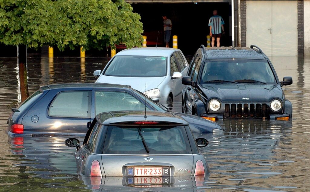
It is exactly four years since Wallonia’s catastrophic July 2021 floods which affected 100,000 people and left 39 people dead. Between 45,000 and 55,000 houses were damaged and more than 10,000 vehicles were destroyed.
Despite recording 19 significant floods between 2007 and 2017, Brussels has been spared from a large-scale disaster. However, despite the city's hills and covered river – flooding is still one of the main natural risks facing the city.
Last year, it emerged that more than half (53%) of the Brussels Region is covered by impermeable surfaces, a proportion that has doubled since 1955 and increased every year since 1993, according to the region's environmental agency, Bruxelles Environment.
It is particularly high in the city centre, and decreases further out: 93% of the 'Pentagon' area has impermeable surfaces, while the inner suburbs have 85% or more. The rate in outer neighbourhoods is 60%.
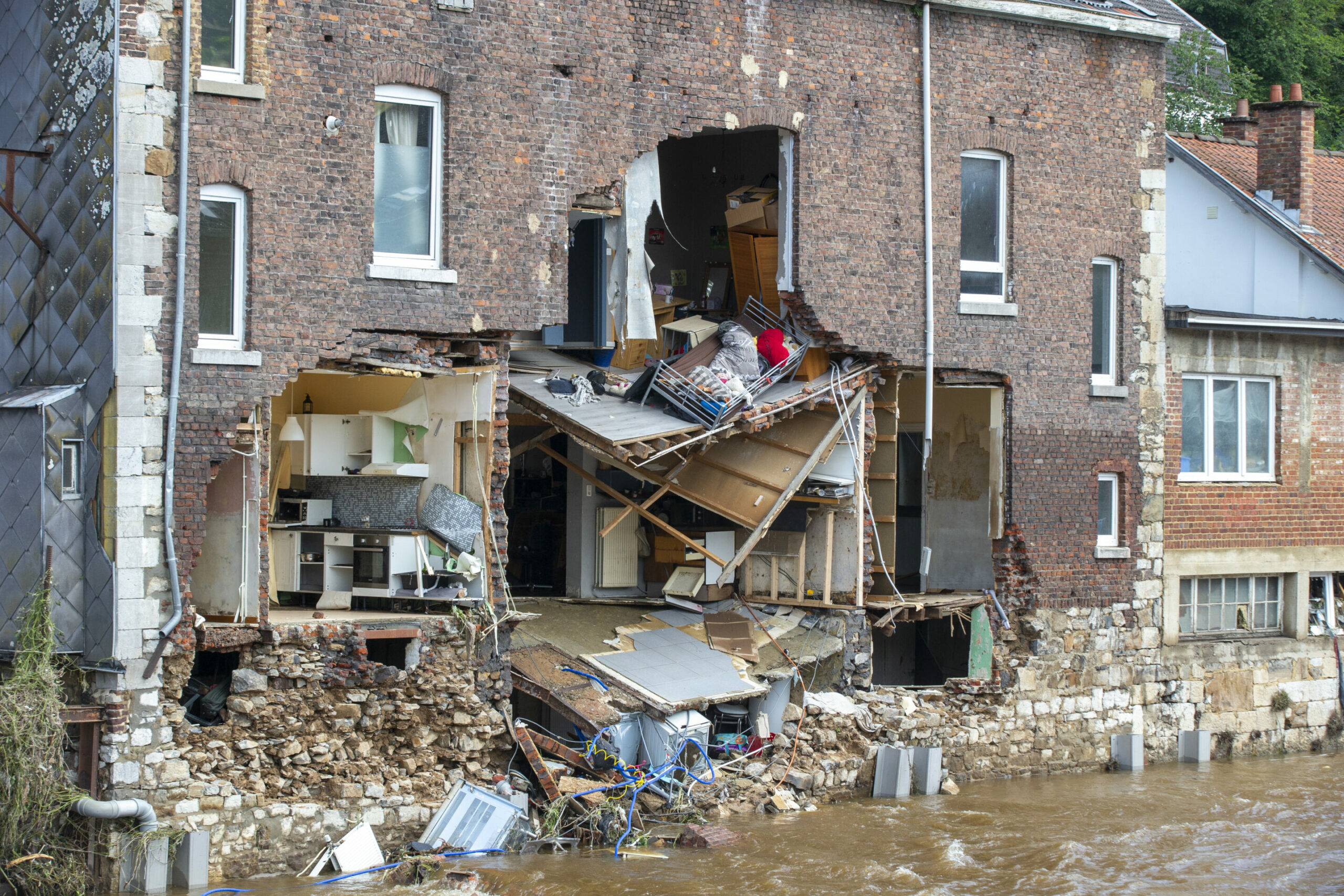
Illustration shows damage a visit to Pepinster, where heavy rainfall caused severe floods, Saturday 17 July 2021. Credit: Belga / Nicolas Maeterlinck
The Brussels Region has been tackling its park renovations with this in mind. The renovated Forest and Cinquantenaire parks will all be fitted with new drainage basins to allow better rainwater management. Other ways of collecting water via roofs and more rain gardens are also included.
Previously, rain had run off the impermeable ground and into the drains. In municipalities like Forest, just under the eponymous park, this caused flooding in its lower parts – but new renovations which include better should help prevent this.
Alert app
In January, the Brussels-Capital Region published a new flood emergency plan (BNIP Flood), mapping out the risk areas as well as listing the key administrative actors in case of an emergency.
To combat floods and minimise their damage, the plan describes the four risk scenarios which could lead to flooding: extreme overflowing of sewers into basements and roads; flash-floods (extreme water discharge via roads); high water levels of watercourses bursting their banks; and obstruction of central Zenne canal.
The Flood BNIP complements prevention and ensures that Brussels is prepared should there be a large-scale flood in the region, the authorities underlined.
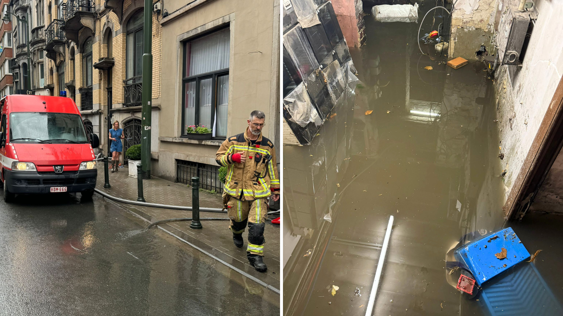
Floods in a Brussels building. Credit: Brussels Fire Brigade
Brussels residents have also been encouraged to download the mobile app of the Royal Meteorological Institute (RMI), to be able to report a flood, or be notified in the event of a flood alert.
Users can send photos to the app, with information forwarded to the relevant hydrological services, namely Bruxelles Environment for the Brussels Region. It also applies for Flanders and Wallonia.
Most floods are short-lived and often occur in very localised areas. It is not always possible for the hydrological services to observe them and assess the damage they cause.
With this reporting system, users can now help the authorities to document them, as all observations of floods are valuable. They can provide Bruxelles Environment with a better understanding of where they occur and the damage they cause, so that appropriate measures can be taken to limit their impact.
Floods usually occur in Belgium during the spring or summer months, following a heavy spell of rainfall.
"Rain cannot be stopped. But if authorities, institutions, associations, companies and private individuals join forces, we can try to prevent or limit flood damage," Sophie Lavaux, who oversees crisis management in the Brussels-Capital Region, said back in January.
Indeed, one of the lessons of the Walloon floods in July 2021 was the importance of prevention measures, with the various contingency plans having drawn from this disaster, both before and after the event.
If interested, check out his interactive map (from 2019) to see if your street is at risk of flooding. N.B. Dark blue means 'high risk', light blue means 'flood risk'.