
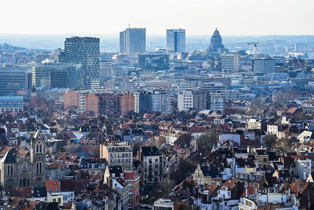
If you've just arrived in Brussels but don't quite know where to settle just yet, here is a brief, handy overview of all 19 municipalities so you can make up your mind.
Brussels evolved from a loose assortment of villages into the metropolitan city it is today. It is often referred to as the Brussels-Capital Region "conglomeration" in French, due to it being a collection of 19 municipalities.
In this two-part series, we explore the vibes, history, and other miscellaneous facts about the different municipalities that form the capital of Belgium and Europe. You can find part 2 here.
Ixelles
Ixelles is seen as the unofficial home of Brussels' international community. This large and affluent neighbourhood is home to large European and Congolese communities.
It includes districts such as the lively Flagey (student living hotspot) and Matongé (Congolese area), while also having the more quaint parts such as Cimetière d'Ixelles and Chatelaine, which is known for being the home of affluent French immigrant communities.
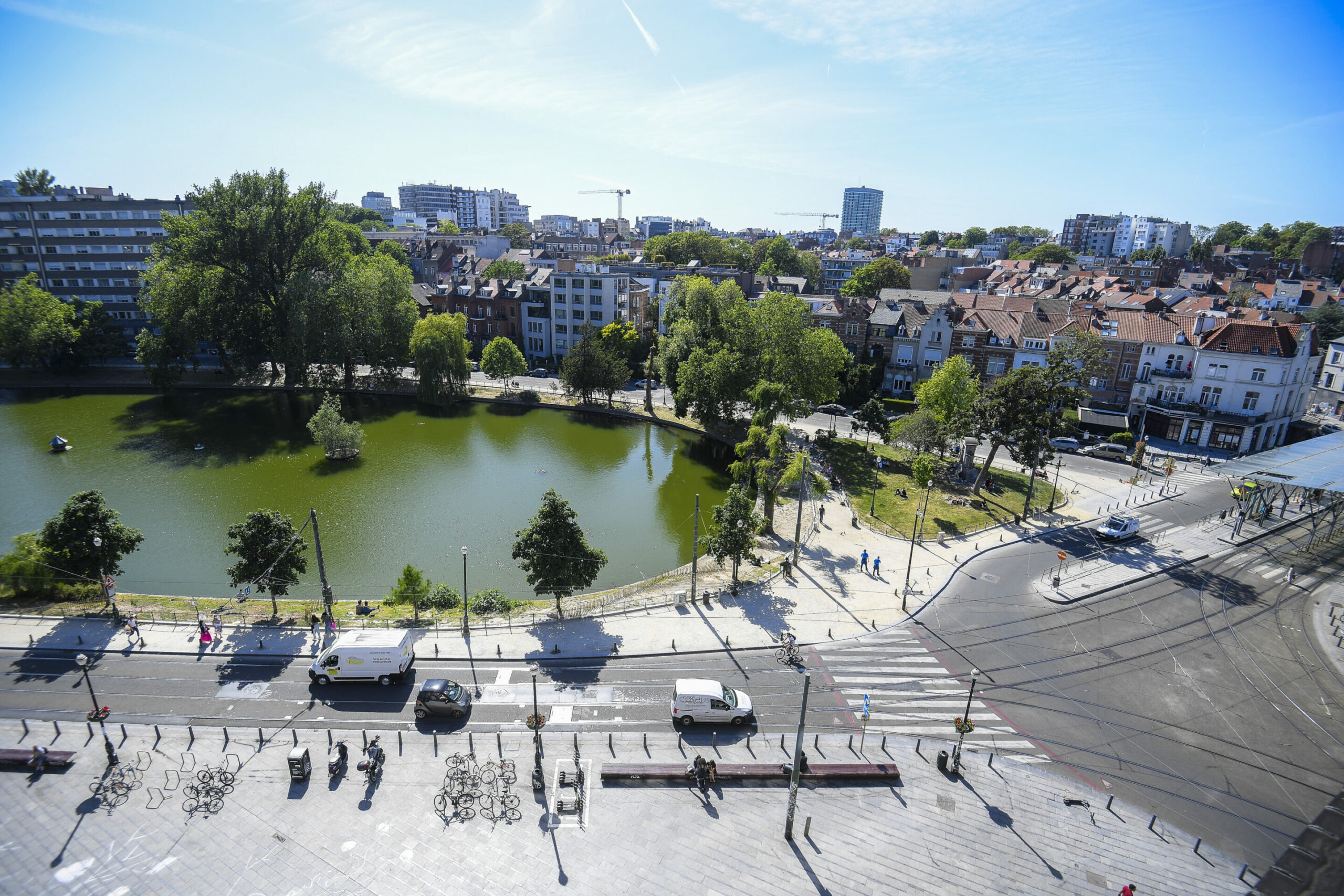
Ixelles Ponds near the Place Eugene Flagey in Ixelles, Brussels, Friday 29 May 2020. Credit: Belga
Ixelles is just outside the original Brussels walls. The name was first mentioned in 1210 as Elsela (Elsene is the Dutch word for Ixelles). In 1795, like many other towns surrounding Brussels, Ixelles was proclaimed a separate municipality by the French regime after the Revolution.
Today, Ixelles is packed to the brim with cafés, restaurants and bars. There are also a number of green areas and parks, notably the idyllic Parc Tenbosch, Jardin du Roi and the Abbey de la Cambre. It also has the highest median price for flats in Brussels.
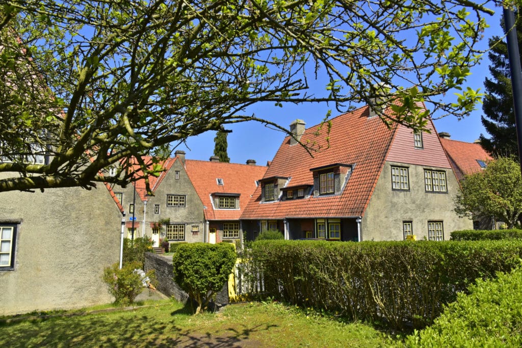
Uccle
Uccle has been the home of the Brussels bourgeoisie for centuries, but the municipality is more diverse than most imagine.
An affluent area, with large mansions and avenues that connect it to the centre. There is also a growing international community due to proximity to embassies and private schools. It is generally seen as peaceful, with parks, vegetable gardens and elegant restaurants.
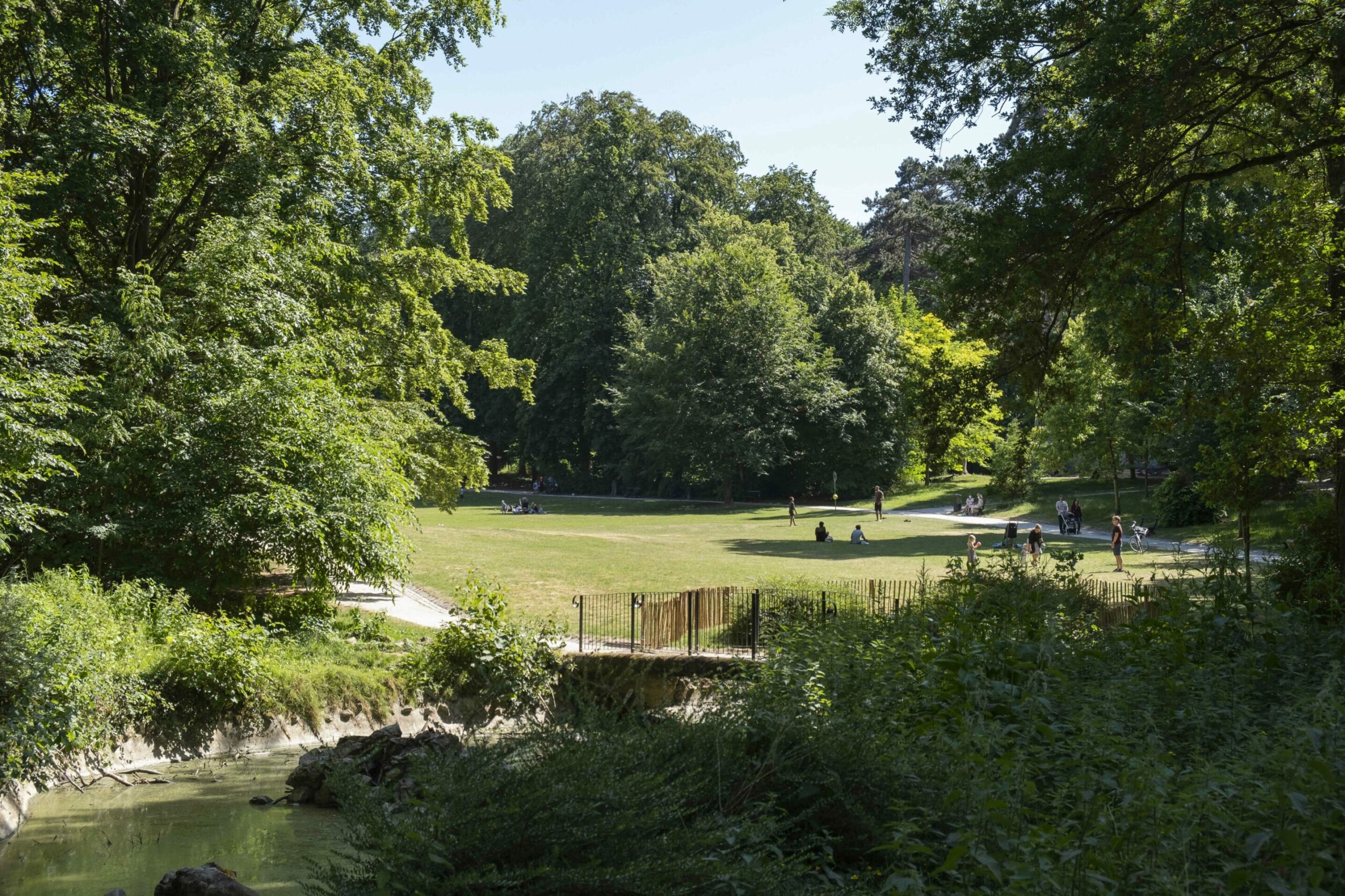
Wolvendael park in Uccle. Credit: Belga / Paul-Henry Verlooy
While the first mention of the hamlet of Uccle is in 1095, the village is believed to be older. Legend has it that the first sanctuary was consecrated in 804 by Emperor Charlemagne and Pope Leo III and dates back to the Carolingian era. Little remains of the old Uccle, with the construction of Avenue Brugmann in 1873 having levelled the neighbourhood as Brussels expanded.
Today, the neighbourhood is quiet and leafy. It is not served by a metro station and has heavy traffic – which helps consolidate its reputation as the car-loving commune of Brussels.
Evere
Tucked away in the north of the city, Evere is another leafy suburb which is mainly known for being the current home of NATO.
Well-connected to Schuman train station, the area is home to many working in the EU institutions, as well as, of course, NATO officials. There is also a thriving IT sector due to its proximity to Brussels Airport, which has also helped to develop a large Indian community.
Evere. Credit: Visit Brussels
Up until the First World War, it was an agricultural landscape with market gardens that put Evere on the map for the cultivation of Whitloof (endives). It was home to Belgium’s first ever aereodrome, which made it a target for bombings during the Second World War. NATO set up its headquarters on the old aerodrome in 1968, further changing the urban demographic.
Today, the suburb has decent transport connections, but notably lacks a metro stop. It enjoys a reputation for not being very fun for nightlife. It is home to the Cemetery of Brussels, where some of the nation’s most illustrious characters are buried.
Woluwe-Saint-Pierre
Leafy Woluwe-Saint-Pierre is seen as a well-to-do municipality, and holds the honour of having the highest house prices in Brussels. It is known for its parks, hills, ponds and grand avenues but also numerous embassies.
One third of Woluwe-Saint-Pierre is green space, with the area having the impressive Woluwe Park, and the sprawling Sonian Forest which crowds the southern edge of the city. It is served by Avenue de Tervuren, which provides good public transport links. It also has impressive mansion buildings like the Stoclet Palace.
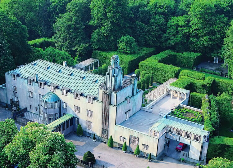
Stoclet Palace. Credit: Ministère de la Region de Bruxelles-Capitale/Unesco
The history of Woluwe can be traced back to the appearance of “Wolewe” dating from 1117. It was an important hamlet with vast farms operated for nearly seven centuries by Park Abbey in Leuven. It used to be joined with Woluwe-Saint-Lambert (often confused), but split in the 15th century.
Today, Woluwe-Saint-Pierre is a safe, affluent and residential area which relies on the service sector. It has a reputation for being clean, while the municipality also strives to be accommodating for newcomers who don’t speak French.
Woluwe-Saint-Lambert
Like its other Woluwe half, Woluwe-Saint-Lambert is a peaceful, safe and affluent part of the city. It has good transport links and a number of green parks.
Among these, it is worth noting the Malou Park, which lines the Woluwe stream that cuts across the park. There is also an old eponymous castle from 1776. Park Roodebeek, which is a forest-type urban setting, even has a mini-zoo with a pony, donkey, goat, rabbits, and more. It also has a number of Art Deco buildings, including the impressive municipal hall.
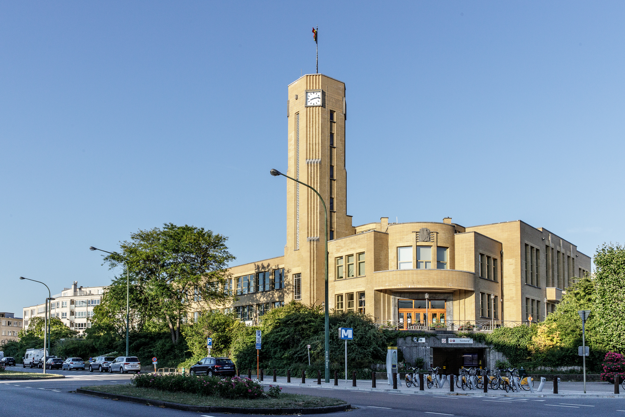
Woluwe-Saint-Lambert municipal hall. Credit: Visit Brussels
The history of the area dates back to the clearing of the Sonian Forest in the 11th century for agricultural exploitation. Until the middle of the 20th century, it was exclusively devoted to agriculture and its related activities such as milling and brewing.
Today, the area is largely residential. It is not known for its nightlife, but is home to the Woluwe Shopping Centre, which opened its doors in the 1960s and is a big favourite among expats.
Etterbeek
Another expat stronghold, Etterbeek is a cosmopolitan municipality which is known for its large international community, a large part connected to the EU institutions ecosphere.
Neatly tucked in between Ixelles and the European district, the municipality borders Cinquantenaire Park, the symbolic national park equipped with sports facilities, museums, including Autoworld and the Royal Military Museum and a mosque.
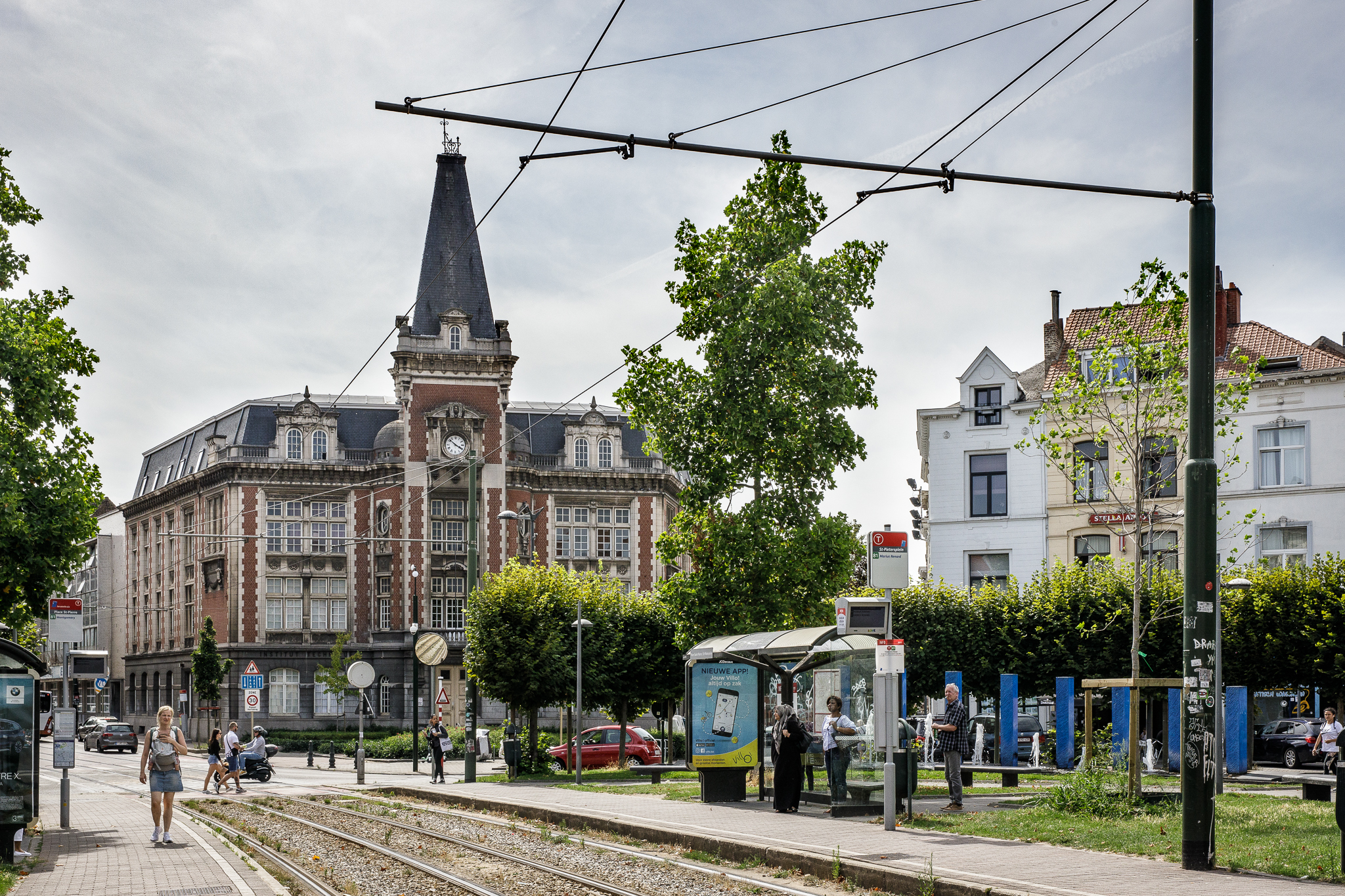
Etterbeek, place St Pierre. Credit: Visit Brussels
The history of the commune is officially noted in a document from 1127, where its name is spelled 'Ietrebecca'. In 1686, Etterbeek had 350 inhabitants and many inns spread over the banks of the Maelbeek valley, made up of 33 ponds. The City of Brussels annexed one-sixth of the territory in 1854.
Today, Etterbeek has many churches and the Art Nouveau gem, Cauchie House. It is also by the university area which is located inside Ixelles. But it is Place Jourdan and its iconic fries kiosk which lies at the heart of this area.
Saint-Gilles
Saint-Gilles gets a reputation for being the trendy home of expats, but the municipality has hosted different migrant communities for over 100 years.
It is split between an affluent upper side, closer to Avenue Louise, and a more working-class lower side – which thrives despite creeping gentrification. It has two hearts, the Parvis de Saint-Gilles on the lower side, and the monumental Municipal Hall in the upper parts. The Art Nouveau houses, including by Victor Horta, speak to the area’s cultural and artistic history. It has a thriving nightlife scene, home to many bars and restaurants. It is also the spiritual home of Union Saint-Gilloise, the Belgian champions who play their games over in Forest.
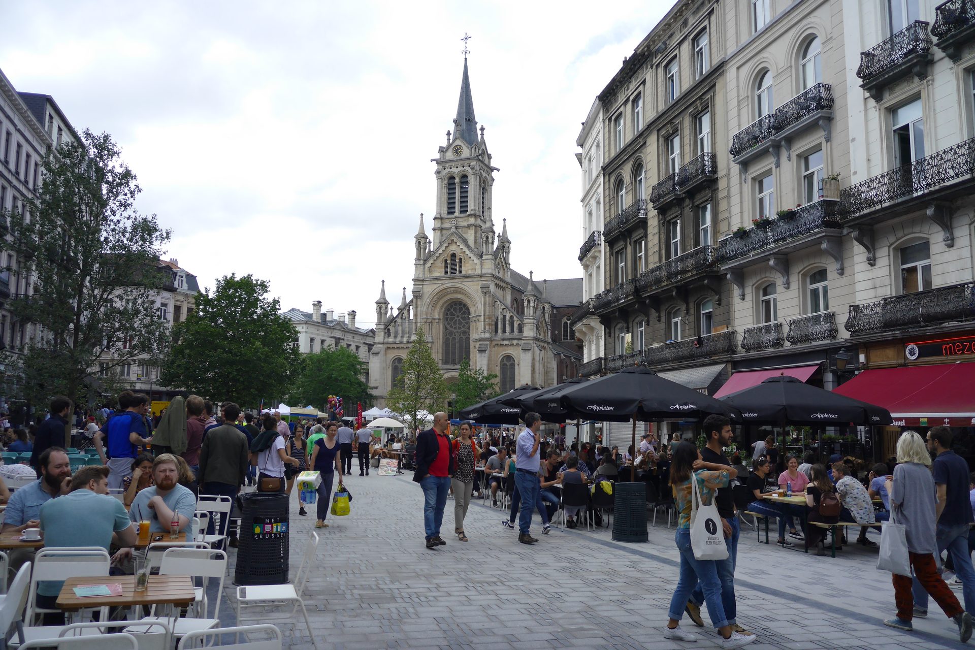
The municipality of Saint-Gilles is home to many international residents. Credit: Belga
Originally known as Obbrussel (to mean "Upper Brussels"), the green hills of Saint-Gilles were used for agriculture – and are believed to be the origin of the now world-famous Brussels sprouts. The area was subjected to rapid urbanisation at the end of the 19th century, which accompanied industrialisation in the new capital of Belgium.
Today, the municipality has security and noise issues related to the drug trade, Brussels-Midi station and the vibrant nightlife. Yet, the neighbourhood still has maintained its character as an urban village near the centre.
Watermael-Boitsfort
Quiet, green and calm are the best ways to describe this suburb in the south of Brussels.
Encircled by Brussels’ green lungs, the Bois de la Cambre and Sonian Forest, this municipality is made for those who love being near nature within an urban setting. It is well-suited for families. It boasts the highest annual income per inhabitant in the Brussels Region, and also has a higher share of Belgian citizens than in other communes. This is despite it being home to the International School of Brussels.
Watermael Boitsfort. Credit: Visit Brussels
The history can be traced to three villages in the forest, Watermael, Boitsfort and Auderghem, that lived together for centuries. The first mention of Watermael was “Guatremal” in an old charter from 909. After the French Revolution, the three were split into separate entities, only to be rejoined by Napoleon in 1811. Auderghem eventually split off in 1862.
Today, with other suburban municipalities, it lacks some of the commercial and nightlife dynamism found closer to the centre. But fear not: the well-loved Market of Boitsfort is held every Sunday.
Forest
In the south, Forest stands tall (literally, with Altitude 100 being the highest point in the city) in Brussels.
The municipality manages to be both extremely green, with both Duden and Forest Park, and extremely urban with its industrialised past. Former brewery Wiels, which today is a modern art museum, is a testament to this. It is also the home of Union Saint-Gilloise, who play their games at the timeless Joseph Marien stadium.
Forest. Credit: Visit Brussels
The famous abbey played an important role in the history of Forest before the French revolution, where it was founded as an administrative entity in its own right. The area was largely covered by woods and marshy lands up until the 19th century.
Today, the higher districts have luxury flats and mansions, while the lower parts in the former industrial zones are still more working class and multicultural.