
This year, the E17 motorway will celebrate its fiftieth anniversary. A new exhibition showing the motorway's transformative effect on Belgium opened its doors in Kortrijk earlier this week.
The free exhibition, organised by inter-municipal company Leiedal in collaboration with various partners, is an immersive experience that grants visitors a unique vantage point from which to comprehend the immense impact that the E17 has had and continues to have, upon the country’s evolution. A rich tapestry of historical images, maps, testimonials, and visual representations converge to provide a comprehensive exploration.
The E17, a linchpin of Belgium's transportation infrastructure, stands as not only one of the nation's most crucial motorways but also ranks among Europe's most bustling freight conduits.
Serving as a vital link between the pivotal cities and ports of Antwerp and Ghent, this artery also facilitates an extensive volume of international freight movement spanning the Netherlands, Germany, and France.
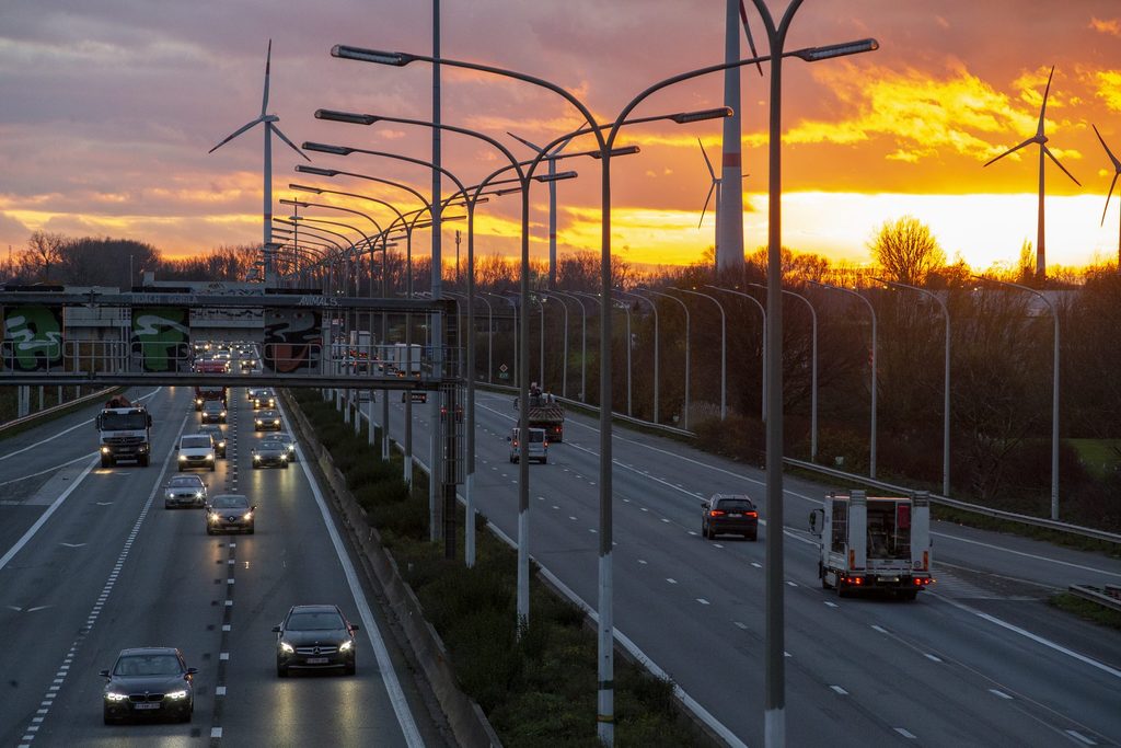
Furthermore, the E17 corridor boasts expansive industrial zones, sprawling across Antwerp, Sint-Niklaas, Lokeren, and the entire expanse between Deinze and the French border. The steady stream of traffic along this route witnesses approximately 25,000 trucks embarking in both directions daily from Ghent to Kortrijk.
While the E17 was not the pioneering motorway in Belgium, its construction timeline stands as a testament to its remarkable efficiency. Predating the E17, the E40 from Brussels to Ostend secured the distinction of Belgium's inaugural motorway.
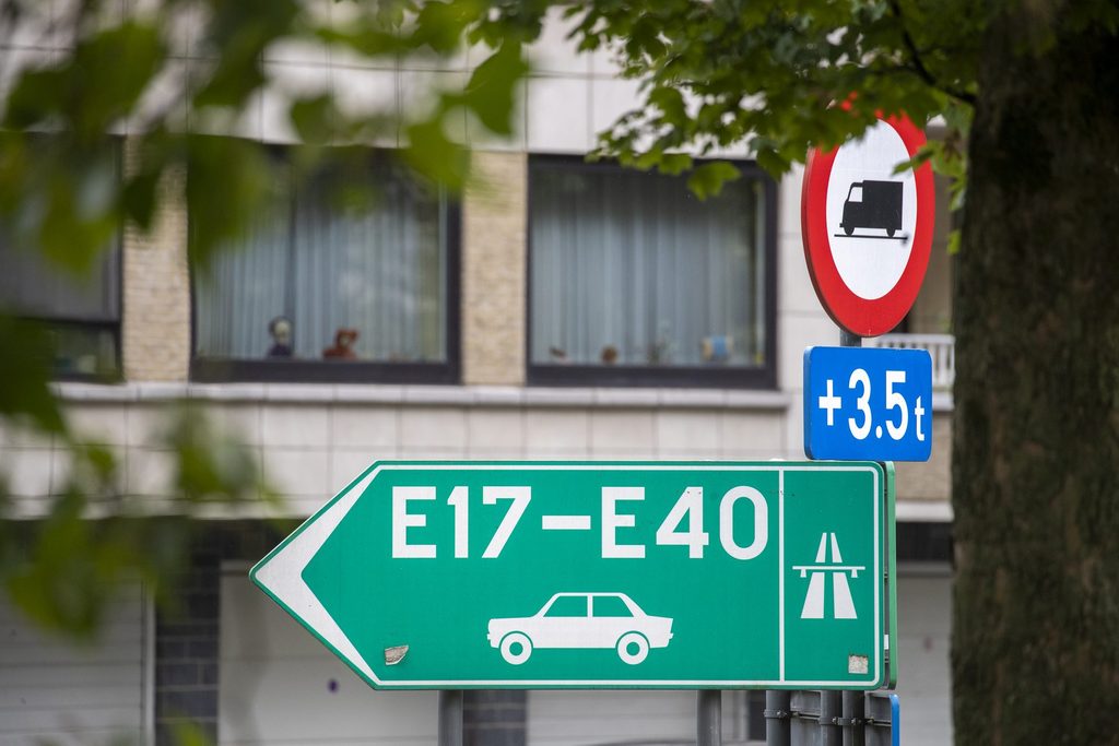
A traffic sign indicating the E17 and E40 highways pictured in Ghent. Credit: Belga / Nicolas Maeterlinck
Commencing in the late 1930s, the first segments materialised in Beernem, West Flanders, concurrently with the construction of Germany's Autobahnen, Italy's Milan-to-Switzerland link, and counterparts in the Netherlands. Second World War intervened, stalling these ambitious endeavours.
The post-1950s era, characterised by the exponential proliferation of cars, prompted governmental bodies to draft extensive motorway blueprints across Belgium, echoing trends in neighbouring nations. Precedence was granted to projects like the E40 Brussels-Ostend, the E313 Liège-Antwerp (vital for transporting Liège steel to the Antwerp port), and the E42 Liège-Mons.
History of E17
Though the path of the E17 was charted in the 1950s, its physical realisation didn’t begin until the mid-1960s. To secure funding, an Intermunicipal Association for the E3 motorway was established under the guidance of Minister Omer Vanaudenhove. interestingly, the E17 was known as the E3 until 1985.
Commencing in 1966 at Kortrijk, the first earthworks heralded the start of a transformative journey. By 1970, the section spanning the French border to Harelbeke had been inaugurated, concurrently with smaller adjoining routes.
For instance, the connection between Destelbergen and Zwijnaarde near Ghent—featuring the iconic Gentbrugge viaduct—marked the fusion of the initial phase of the Ghent ring and the E40. Similarly, the Kennedy tunnel emerged in 1969, facilitating the Kruibeke-Antwerp route via the freshly minted R1 ring road to Merksem and Brasschaat.
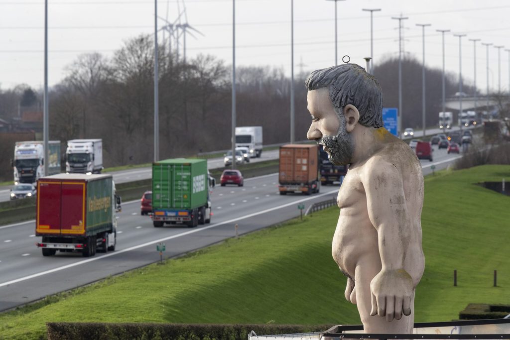
The Naakte Reus (Naked Giant) statue at the E17 highway in Waregem. Credit: Belga / Nicolas Maeterlinck
The remaining extensive stretches from Harelbeke to Zwijnaarde and from Destelbergen to Kruibeke reached completion in 1973, a testament to the project's breathtaking pace.
This era, devoid of environmental impact assessments and measurements, witnessed governmental directives swiftly carving through landscapes, securing lands through expropriation, and raising asphalt. Such an approach is unthinkable in the present day.
Economic renewal
Beyond the landscape-altering expropriations and the division of villages along its path in the late 1960s, the E17 ushered in a wave of prosperity.
The industrial advancement of South-West Flanders, along with other regions connected by the motorway, would have encountered significant obstacles without its presence.
During the 1950s and 1960s, the extensive Kortrijk area grappled with elevated unemployment rates. This disparity arose as West Flanders found itself sidelined amidst post-war foreign investments, which fostered employment hubs elsewhere in Flanders, such as Antwerp's petrochemical sector and car manufacturing in Limburg.
Interestingly, although the land adjacent to the E17 was not originally earmarked for commercial parks, these entities flourished there. Local entrepreneurs relocated their businesses from older residential zones to the expansive domains lining the motorway, accessible not just to Flanders but all of Europe.
Today, an unbroken ribbon of corporate establishments unfurls from Deinze to Kortrijk. South-West Flanders now boasts one of the highest employment rates in the Flemish regions.
The exhibition titled "50 Years of E17/E3: Charting the Course of the Motorway," is open until October 8th.