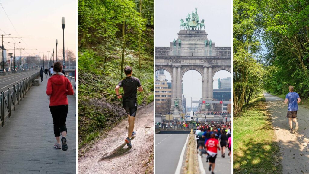
As a runner in Brussels, especially in traffic, you are a vulnerable road user – which is why seasoned city-runners will tell you it's best to find a park or a forest if you want to avoid the crowds, as well as potholes or hard asphalt (your knees will thank you).
Here are some of the most beautiful routes, parks and areas to go for a run in Brussels.
Sonian Forest
Readily accessible by car or public transport, or through the Bois de la Cambre, the expansive Sonian Forest has beautiful routes for those who want to run surrounded by green.
Three easy-to-follow jogging loops (5 km, 10 km and 20 km) start at the ADEPS Centre in Auderghem – not far from the beautiful Rouge-Cloître. As the forest covers an area of 1,654 hectares in the Capital Region, there is plenty of space for those who do not want to stick to pre-arranged routes. But be warned, the trails can be very hilly.
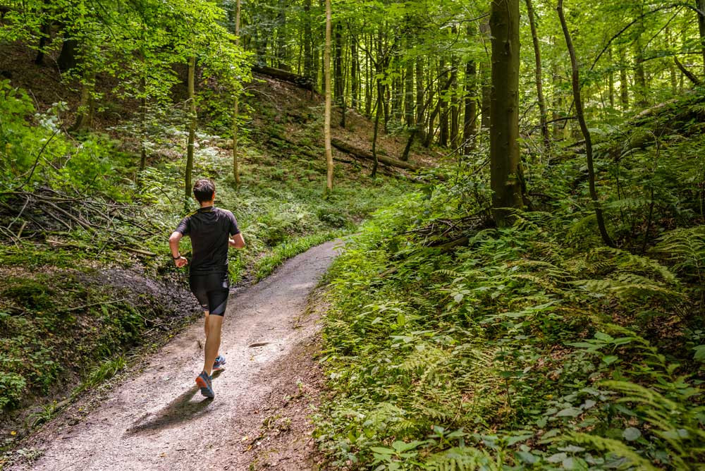
Running in the Sonian Forest. Credit: Visit Brussels/Jean-Paul Remy
Good to know: Part of the forest was recently added to the UNESCO World Heritage List. Those who use the enchanting Sonian Forest and its remarkable ecosystem as their stomping ground will find this an unsurprising addition.
Bois de la Cambre
If you do not want to go as far as the Sonian Forest but still want to move among the trees, the Bois de la Cambre might be the running spot for you. The 1 km² green oasis on the edge of the city offers many forest trails, open lanes and routes for runners looking to escape the crowded city for a bit.
You enter the park via Avenue Louise, Chaussée de Waterloo, Avenue Franklin Roosevelt or Chaussée de Terhulpen, and map out your route depending on your entry point.
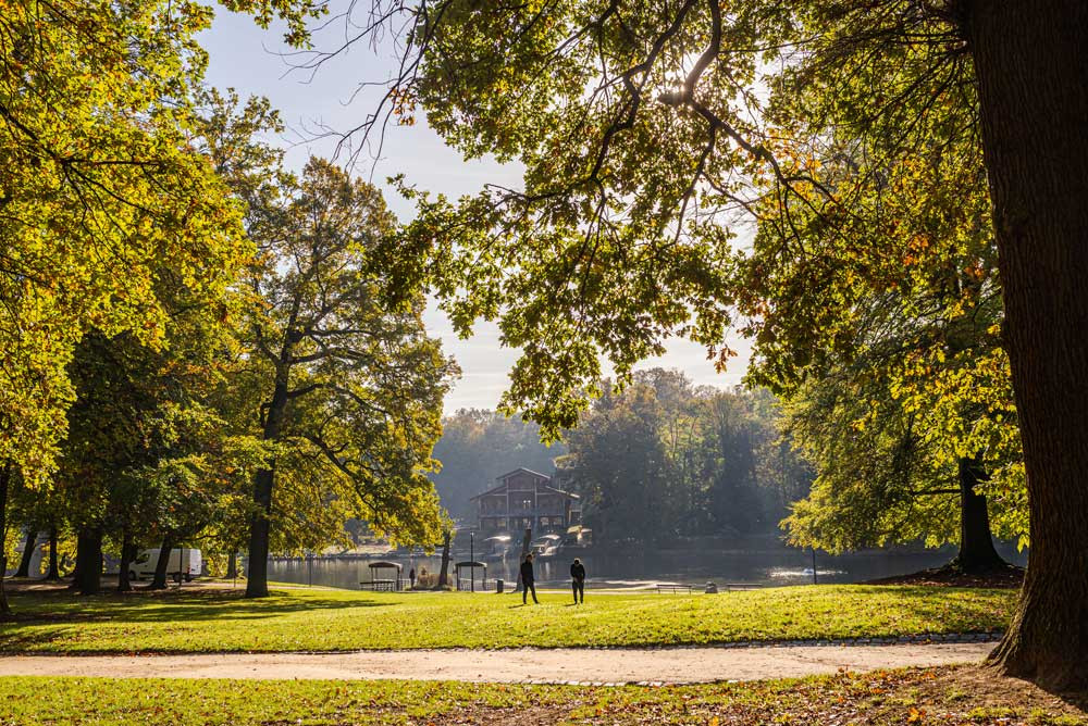
Bois de la Cambre. Credit: Visit Brussels/Jean-Paul Remy
Whichever route you take, make sure to run along the pond in the middle of the park (and hydrate at one of the drinking fountains). Once you're done, you can even treat yourself to a tasty ice cream from Capoue, or a little snack and a refreshing drink at Woodpecker.
Bon Pasteur Park
The Bon Pasteur ("Good Shepherd") park in the municipality of Evere is part of "het moeraske" – a small green space in the shadow of the railway line with more than enough space for running in the north of Brussels.
Once you have made your way through that area, cross the railway and the canal, and continue your jog towards Laeken Cemetery, Laeken Park and Osseghem Park. You could even visit Mini-Europe and/or the Atomium once you're there.
Bon Pasteur Park. Credit: Visit Brussels
Parc de Cinquantenaire
Many of Brussels' runners know Parc de Cinquantenaire as the start and finish line of the 20 km race through Brussels. But despite its impressive triumphal arch, the park is also perfectly suited to shorter jogs.
But if you are looking for a slightly longer one and do not mind alternating green spaces with cityscapes, the park can also be a good starting point for a run into the Parc de Woluwe – just 2 km away – and explore its ponds and greenery before making your way back and finishing underneath the triumphal arch.
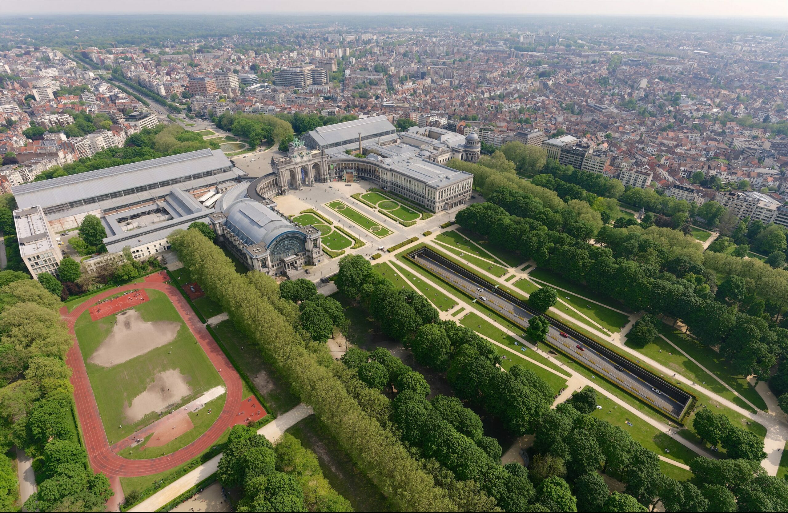
Cinquantenaire Park from the sky. Credit: Simon Schmitt / GlobalView / Beliris
Parc Josaphat
With its 40 hectares, the hilly English-style Parc Josaphat is the green lung of the municipality of Schaerbeek, and has been known to Brussels' runners for years. Since its renovation, the park is a green gem with expansive lawns, ponds, and flowerbeds – the perfect setting for a nice run.
The park trails are a loop of roughly 2.5 km, making it the perfect location for a relaxing jog surrounded by greenery, water, and (farm) animals while still regularly coming across other people walking, picnicking, or just relaxing.
Park Josaphat in Schaerbeek. Credit: Lauren Walker/The Brussels Times
The Green Walk
Ready for a big outing? While easier to do in one day as a cyclist, the Green Walk (or run) is definitely a must for those who like to run in nature but do not want to leave Brussels.
This is a 63 km loop around Brussels, passing through numerous parks and nature reserves: the route is divided into seven walking trails that highlight different facets of the Capital Region, with an average length of 5 to 12 km showing the diversity of the Brussels landscape (urban, rural, industrial, etc.).
Be sure to use the handy map, which you can also consult on your smartphone for the detailed routes.
Credit: Visit Brussels/Jean-Paul Remy
Prefer to find your own way?
Following a survey of 1,500 Brussels residents, perspective.brussels commissioned the 'Be running' guide and map to inform runners and walkers about pleasant routes in Brussels.
While the survey showed that continuous routes, green spaces, and road safety are particularly important to Brussels pedestrians, this is not always a given in such a densely built-up urban environment. Therefore, the 'Be running' routes should offer a solution.
People can use the routes to move from one green space to another, and can download them to their phones. Not just a regular map, the demarcated areas take into account the habits of joggers to connect the Brussels parks, the canal and the Green Walk via special pedestrian paths where there is room for every walking and running speed.