

Belgium will face a mixed bag of weather on Tuesday as showers, isolated thunderstorms and sleet move across the country from the west.
Early in the morning, western Belgium can expect showers, while central areas should remain mostly dry with some bright spells, although patches of fog are likely.
As the day progresses, conditions will turn variable across low and central Belgium, with heavy cloud cover and scattered showers punctuated by occasional clear intervals. The chances of rain, thunder and sleet will be highest in the west.
Further east, skies will stay overcast throughout the day with intermittent precipitation. Wintry weather may persist over the higher ground, where visibility could be poor. Temperatures will range from 2°C in the Hautes Fagnes to around 9°C along the coast.
Winds will be light to moderate from the north to north-west inland, but stronger along the coast, where they could reach 70 km/h and briefly exceed that during showers.
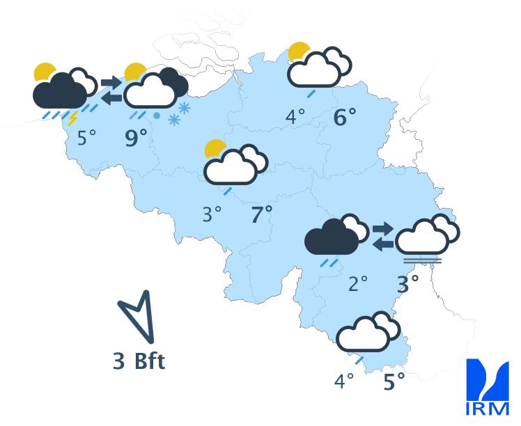
Credit: RMI
Tonight, showers moving in from the North Sea will continue to affect western areas. From the centre to the east, conditions will gradually turn dry as low cloud and the risk of freezing fog develop.
Minimum temperatures will dip to -1°C in parts of the Ardennes and climb to around 7°C at the coast, with a light to moderate north-westerly wind inland and stronger northerlies lingering along the shoreline.