
A cloud of dust from the Sahara desert is currently above the Atlantic Ocean and will likely reach European shores on Wednesday, forecasts from the Copernicus Atmosphere Monitoring Service (CAMS) show.
In the coming days, dust clouds from the Sahara will blow over northern and central Europe for the first time this year. The European weather service warns of showers of Sahara dust that originate from countries such as Morocco, Algeria and Tunisia.
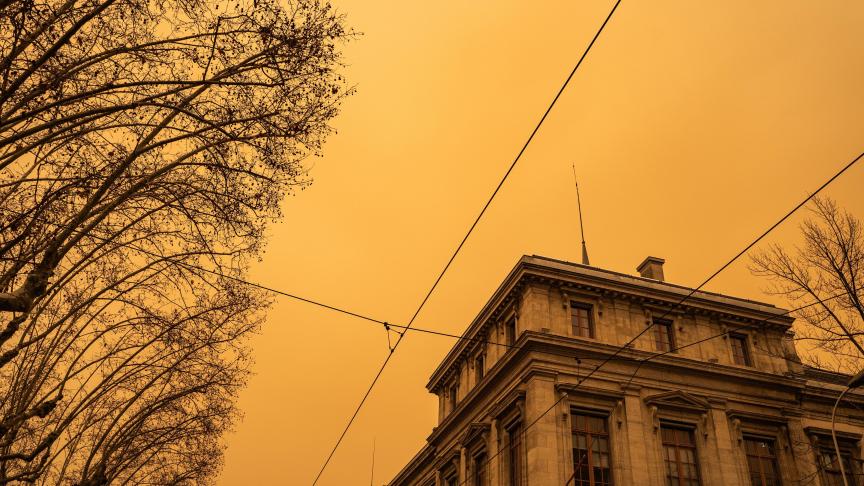
"It is not unusual to see Saharan dust across Europe at this time of the year. The typical impact is red or orange sky but there is the potential for impacts on surface air quality, particularly in Spain and Portugal," wrote Mark Parrington, Senior Scientist at the Copernicus Atmosphere Monitoring Service.
"In recent years we have also seen Saharan dust on the ground in the Pyrenees and the Alps, where the mountains are high enough to intercept the longer-range transport at higher altitudes."
As long as the weather remains dry, Sahara dust fractures sunlight, turning the sky orange or even a spectacular red. This is especially noticeable in mornings and evenings when the sun is low. But with rain showers currently forecast in Belgium, it is possible that the dust will be mixed with the precipitation.
Related News
Sahara dust can affect human health and air quality: the particles can cause irritation to the respiratory tract. In general, Copernicus expects a stronger impact on air quality for Spain and Portugal.
The dust could also have an effect on the energy sector, as the particles can deflect solar radiation, thereby lowering the output from solar panels.