
An earthquake hit Liège on this day (8 November) 40 years ago, killing two people and causing mass destruction, but also prompting the country to anticipate such tragedies in the future.
The earthquake, whose epicentre was in Saint-Nicolas, a densely populated municipality in the west of Liège, shook the city overnight (at 01:49 local time) on 8 November 1983.
It was a relatively strong earthquake, measuring as 5.0 on the Richter Scale and a maximum intensity of over VII on the 12-part Mercalli Scale. It was even felt in Amsterdam (Netherlands) in the north, Frankfurt (Germany) in the east and Metz (France) in the south.
The hypocentre – the point within the earth where an earthquake originates – was located at a shallow distance of 5.8 kilometres below the city, explaining why there was a lot of damage in the immediate area. Around ten aftershocks also followed the quake.
Fatal disaster
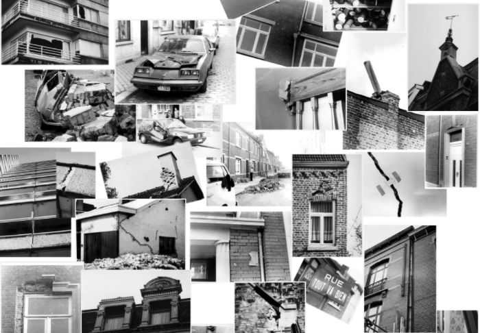
Two people were killed by falling debris and dozens were injured. In the communes of Saint-Nicolas, Glain and Montegnée, as well as in the cities of Liège, Seraing, Ans and Grâce-Hollogne, more than 16,000 houses were damaged. Of these, 37 were completely destroyed and 129 were declared uninhabitable, leaving over 1,000 people homeless. Many parked cars were also damaged by falling debris.
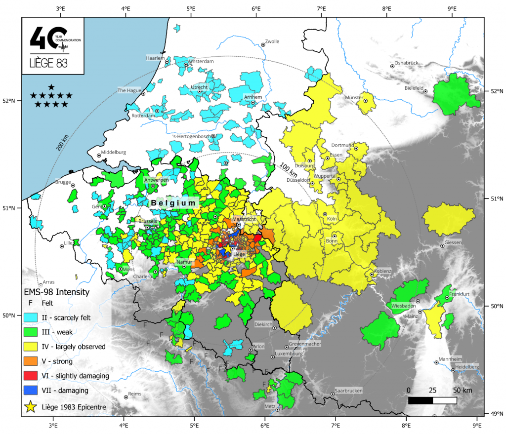
Map of Belgium and surrounding region with dotted colours showing the intensity of the 1983 Liège earthquake. The highest intensity is shown in the area around Liège. Credit: ROB
The total damage amounted to three billion Belgian francs at the time (roughly €75 million). It was soon recognised as a natural disaster, meaning residents could seek compensation for damage to their homes from the National Disaster Relief Fund.
At least 16,000 damage files with detailed descriptions were created at the time, and more than €100 million worth of damage was eventually paid out. This archive of files is currently kept in the General State Archives and is rare in Western Europe. It is a very rich database for assessing the financial impact of a shallow earthquake in urban areas.
The widespread devastation of the earthquake that was recorded in these compensation files made authorities realise the importance of closely monitoring seismic activity in the country.
Modern equipment
During the 1983 earthquake, the Seismology Department of the Observatory had just four seismographs (instruments used to record earthquakes) at its disposal in Uccle, Dourbes, Membach and Walferdange (Luxembourg). Records of vibrations were available only in analogue and on paper, meaning that transmitting information either physically or by telegram took a long time.
The calculation of magnitude and depth, which are crucial parameters to calculate the impact of an earthquake, was also a slower process at the time and could take hours or even days. This prompted the installation of a modern seismic network in Belgium.
Currently, the Royal Observatory of Belgium (ROB) operates a modern seismic network (with 29 surface and borehole seismometers and 16 accelerometers) spread across the Belgian territory, allowing seismologists to determine the location, magnitude and depth of an earthquake in minutes.
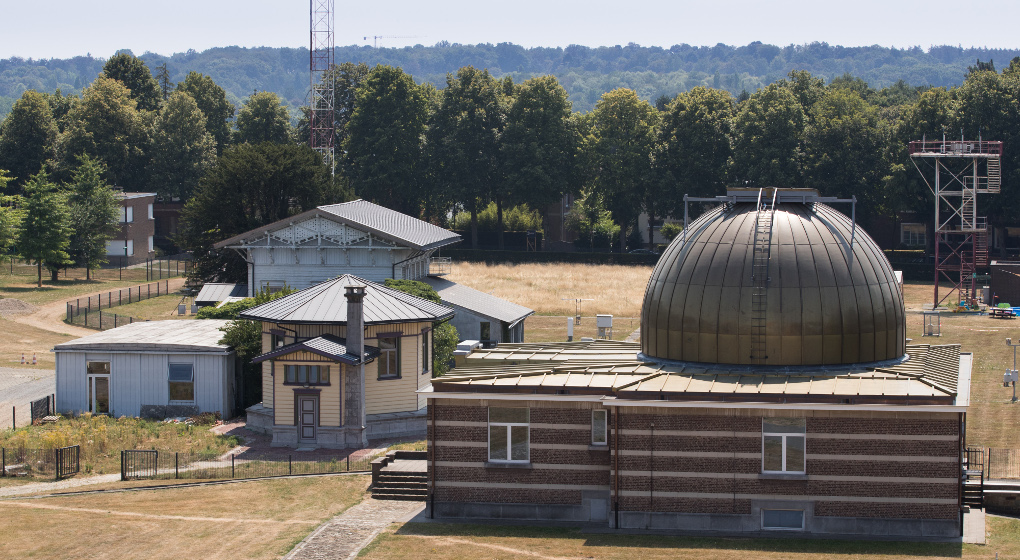
Belgium's Royal Observatory. Credit: Belga
The earthquake of 8 November 1983 is being commemorated by the ROB on Wednesday during a scientific study afternoon.
It will be attended by Liège city authorities, national and regional crisis centres, federal and regional authorities, geologists, seismologists, and engineers from all universities in Belgium.