
For more than ten days, Westhoek in West Flanders has been tormented by heavy rain. Now the severity of the floods and the emergency response required will likely see the situation recognised as a "disaster", triggering exceptional measures.
Minister-President of Flanders Jan Jambon said on Friday that the damage will "most probably" be classified as a "disaster" by the Flemish government. He noted "exceptional proportions" of the floods and gave assurances that "Everything is being set in motion to help those suffering damage as quickly as possible."
To classify exceptional weather phenomena (such as extreme drought or flooding) as a disaster, the Flemish government must confer with the Royal Meteorological Institute (RMI) and the Inspectorate of Finance. Both bodies have been asked to assess the actual situation.

People working at the site of flooding in Woumen, Diksmuide. Credit: Belga/ Kurt Desplenter
The disaster classification allows people who have been affected by extreme weather to apply for compensation from the Flemish Disaster Fund. Providing that the floods are recognised as such, Jambon said that applications for assistance will be processed quickly.
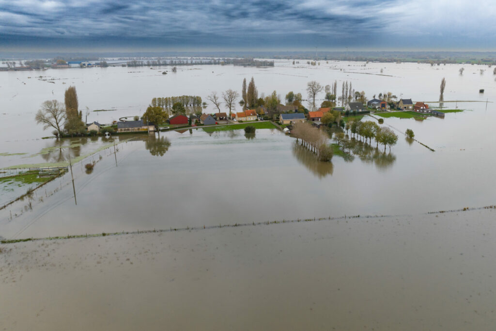
Record water levels
The relentless rain started on Monday 6 November, with the governor of West Flanders declaring the provincial emergency plan for the Westhoek region at the end of last week.
One week later, people were being evacuated from their homes as figures from Water Info (a database that records water levels at rivers and water basins) showed on Thursday that excessive rainfall had set all-time highs at 17 of the 20 points where water levels are measured in West Flanders.

King Philip visited Diksmuide – one of the worst-affected areas – on Friday morning. He met representatives of the emergency services and flood victims. Credit: Belga/ James Arthur Gekiere
In Poperinge and the vicinity, 196 litres of rain fell per square metre in recent days – more than double the median of all Flemish measuring points (82 litres). Not far off, Ypres saw 169 litres over the same period.
The soil is completely saturated in many locations, meaning rain can no longer be absorbed by the subsoil and making it susceptible to flooding. Water levels stabilised thanks to drier conditions on Thursday afternoon and on Friday. However a new rain zone is expected on Saturday.
Dramatically unprepared?
The region has recently been investing in water management during heavy rainfall. Since the emergency plan was announced on 10 November, various organisations on the ground carried out urgent efforts to pump excess water and reinforce dykes.
The Flemish government announced on Friday a task force of government experts and local actors to assess how to "avoid such disasters as much as possible in the future". The team will focus especially on how to protect the Westhoek and more specifically the IJzer basin.
But Flanders is asking for additional efforts from France, with the region's Minister for Public Works Lydia Peeters saying that otherwise Flanders is "literally mopping the water with the tap running". Peeters added that "facilities are currently insufficient to discharge such extreme flows from the Ijzer to the sea. We are doing all we can to get the water out as quickly as possible but we must also look to how we can avoid such scenarios in future."
Related News
- Floods in Flanders: Evacuations underway as heavy rainfall continues
- Rehearsing for Belgium's worst flood: European emergency response teams practise in Hasselt
Environment minister Zuhal Demir echoed that Flanders will continue to face the consequences of climate change and that the events in Westhoek convinced her that the focus on climate adaptation is the right one.
She pointed to adaptation plans such as the Blue Deal – a regional initiative to protect Flanders against both drought and flooding. "The floods prove that we need to continue and scale up these efforts for decades to come."