
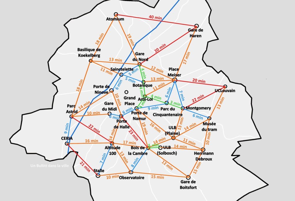
A series of tweets published by a Brussels bicycle courier have revealed a number of different maps showing estimated cycle times between different locations in Brussels.
According to the first map posted on Twitter on Friday, it takes a cyclist 12 minutes to cycle from Parc du Cinquentenaire to Gare du Nord, 58 minutes to cycle from the Atomium to Observatoire and around 46 minutes to cycle from UCLouvain to Gare du Midi.
Since the first map surfaced online, a series of other tweets revealing similar maps for the different Brussels communes have appeared on the same Twitter account.
Bon bah on est presqu'au bout là. Que trois communes aujourd'hui pour faire durer le plaisir ? pic.twitter.com/6Eskp8YY9u
— Un Bullitt dans la ville (@BullittEnVille) January 7, 2020
Importantly, however, the individual behind the twitter posts explains that the indicated times are only theoretical. There are many factors, such as how fast one peddles, how many red lights one crosses and if the bicycle being used is electric that will change the journey times.
In terms of methodology, the journey times are an average of the times taken to cycle in both directions "because, yes, Brussels isn't flat, in case you haven't noticed," a tweet explained. Google Maps were also used to help calculate the average journey times.
The courier reportedly was inspired to create the maps after seeing that the French daily, Le Parisien, had published similar maps showing estimated bicycle travel times between different destinations in Paris during the recent transport strikes, New Mobility reports.
Evie McCullough
The Brussels Times