
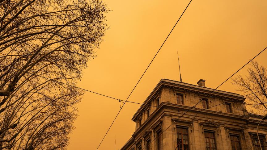
Another surge of Sahara sand is expected in Belgium this weekend. This phenomenon is famous for giving the sky a red-orange hue, but could also cause temperatures to be lower than the 24°C predicted for Saturday.
Photos of the Alps appeared last week showing the normally snowy mountains covered in Sahara sand and an orange hue in the sky: about 180,000 tonnes of Saharan dust was measured in the air over Switzerland. Now, the chances of this happening in Belgium are also increasing, online weather reporting service Noodweer Benelux has announced.
"The various weather models predict a solid upsurge of Sahara sand in the upper layers of the atmosphere on Saturday as well as Sunday," it stated on its website. This would mark the first surge in Belgium in almost two years, having last occurred in March and in May 2022.

Credit: Météo Express
While these hazy, orange skies may be good news for photo enthusiasts, the sand particles could also block the sun's rays, which "could then cause temperatures to drop slightly." Temperatures in the centre of the country were initially expected to soar over 20°C this weekend.
When a gust of Sahara sand passed over Belgium in March 2022, temperatures were 5°C lower than expected. The exact impact depends on the thickness of the layer of sand. "Only on Saturday itself will we be able to assess whether 24°C is really possible," warned Noodweer Benelux.
Why is the Saharan sand arriving here?
On Friday night, a heat front will pass over Belgium from south to north. By Saturday afternoon, between a low-pressure area on the Atlantic Ocean and a high-pressure area over Italy, a tight southerly updraft will be formed that picks up Sahara sand from Africa. "It can then transport it far to the north."
The Royal Meteorological Institute (RMI) noted that there may be strong winds from the south on Saturday, which would further push the sand north. The first peak will be reached on Saturday evening.

Map shows arrival of Saharan sand on Saturday. Credit: Noodweer Benelux
"The sun may appear hazy during the day as a result. Also, the sky will not be completely blue and temperatures may be slightly lower," Noodweer Benelux explained.
While a cold front usually causes a fairly rapid eastward movement of the sand, this will not be the case this time. "Even on Sunday, this plume of Sahara sand will likely still be in Belgium. From the west, a cold front will gradually move the sand to the east."
On Sunday, the dust load over the east of Belgium but also the Netherlands and large parts of Germany could exceed 3000 mgr/m². "These are very high values." Large amounts of sand can be harmful to people's health. Especially high concentrations of dust can negatively affect air quality and aggravate respiratory and cardiovascular conditions.
Only after the weekend will Atlantic depressions move the Sahara sand eastwards, which will be accompanied by an increase in precipitation and winds, and lower temperatures.