If you've just arrived in Brussels but don't quite know where to settle just yet, here is a brief, handy overview of all 19 municipalities so you can make up your mind.
Brussels evolved from a loose assortment of villages into the metropolitan city it is today. It is often referred to as the Brussels-Capital Region "conglomeration" in French, due to it being a collection of 19 municipalities.
In this two-part series, we explore the vibes, history, and other miscellaneous facts about the different municipalities that form the capital of Belgium and Europe. You can find part 1 here.
Anderlecht
While Anderlecht has been getting a bad reputation in recent years, there is much more to the cosy and culturally-minded area than the drug-related violence you read about.
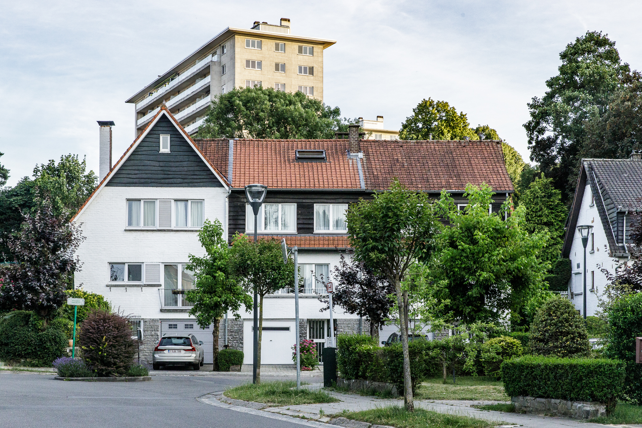
With a population of over 120,000, Anderlecht is the Capital Region's second-largest municipality. The sprawling area houses a wide variety of neighbourhoods: garden suburbs to industrial areas and high-rise buildings, but also villas, townhouses and bel étage houses. Anderlecht also boasts numerous green spaces, featuring smaller city parks and larger green areas interspersed throughout.
Anderlecht. Credit: Visit Brussels
The name 'Anderlecht' was first mentioned in 1046, but the municipality's history goes back much further: traces of prehistoric habitation, and of a Frankish cemetery built on the remains of a Roman villa can be found in the Sainte-Anne district in the middle of the suburb. Anderlecht was annexed to the city of Brussels from the end of the 14th century until 1796, before becoming an independent municipality at the end of the Ancien Régime.
Today, Anderlecht has something for everyone: from lively and densely-populated neighbourhoods with local grocers and the large weekly Abattoir markets to a host of creative, cultural and community spaces, while also offering quiet and large open green spaces to those further from the centre. Internationally, the commune gained fame thanks to its football club RSC Anderlecht, which has won the most titles of any Belgian football club and often advances to European competitions.
City of Brussels (Brussels 1000)
Most commonly known as the true centre of the Brussels-Capital Region with most of the touristy hotspots, the municipality's strange borders mean that this area is much bigger (and more diverse) than most think.
With an area of 32.6 km², the City of Brussels is the largest municipality in the Brussels-Capital Region. Its population of over 175,000 inhabitants is spread across the busy historic city centre enclosed by Small Ring Road, the stately European and North Quarters, the more upmarket Louise-Roosevelt axis, the diverse Laeken, rural Haren, and village-like Neder-Over-Heembeek.
Place Sainte-Catherine, in the centre of Brussels. Credit: Visit Brussels
Brussels originated around a castle on an island in the Senne, but when the city expanded, the first city walls were built – parts of which are still preserved today. However, they soon proved to be too small, and a second pentagonal city wall was built, encompassing the city's seven hills. Of this second wall, only the tower of the Porte de Hal remains above ground.
Today, the City of Brussels is a vibrant part of the Region. Densely built-up with predominantly rental properties, the city centre has bars, restaurants, music and cultural venues, schools, libraries, sports halls and shops all within walking distance – a must, as large parts of the centre are pedestrianised. Due to Brussels' international character, as well as the large number of residents from Flanders and Wallonia, there are few "true Brusselseirs" left in the city.
Ganshoren
In the shadow of the Basilica of Koekelberg, the small municipality of Ganshoren is located on the edge of the Region.
Houses approximately 24,000 residents in an area of just 2.5 km², Ganshoren is mainly defined by high-rise blocks, detached houses and low-rise apartment buildings, with relatively few amenities. Instead, the municipality offers peace, space and greenery; the Marais de Ganshoren is definitely worth a visit.
Ganshoren. Credit: Visit Brussels
Ganshoren used to be part of the 'Jette-Ganshoren' municipality until 1841, when it was split into two. The municipality used to belong to the Dutch-speaking part of the former province of Brabant, but became part of the bilingual Brussels Region in 1954, after the country's ten-yearly language census.
Today, the small municipality is well-connected to the rest of Brussels by public transport. Ganshoren gained fame for having elected the first black mayor in Belgium in 2018, Pierre Kompany (who is also the father of the famous Belgian football player Vincent Kompany).
Jette
The municipality of Jette calls itself a village within the city, and with its pleasant squares, cosy shops and Sunday market famous far beyond the municipal boundaries, it certainly feels like one.
Jette's neighbourhoods are mainly working-class or residential, with taller apartment buildings and flats, but also some stately mansions and bel étage houses in the surrounding streets. While many consider it to be quite far from the city centre, Jette is well-connected by train, tram, metro, and bus – making the University Hospital, with its student campus, easy to access.
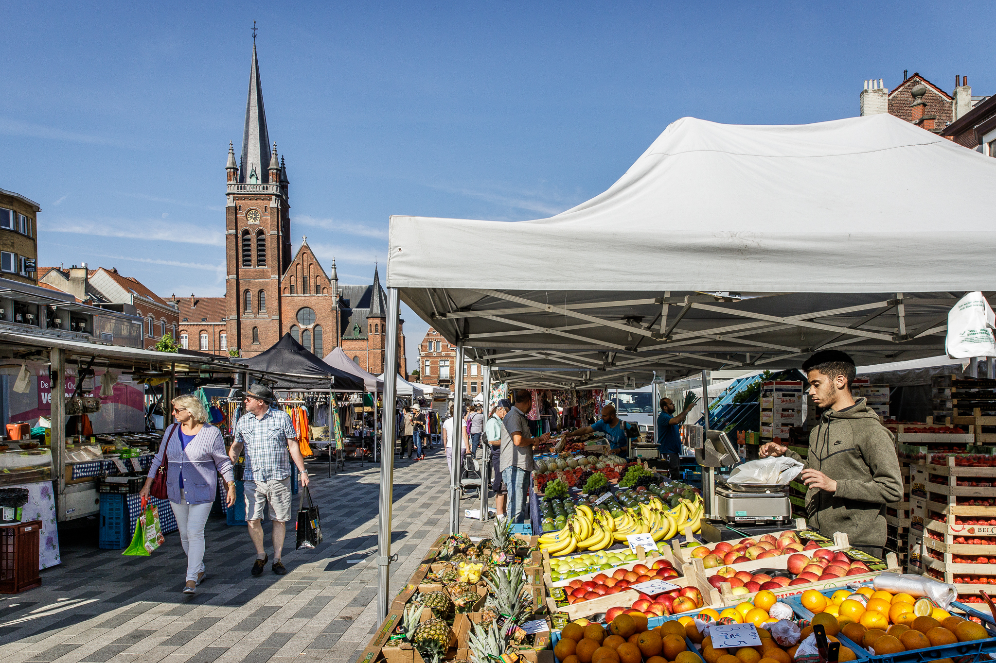
Market in Jette Credit: Visit Brussels
The Dieleghem Abbey was founded in 1095, and played an important social and economic role until the French Revolution. The monks were expelled from the Abbey in 1796, and most of the buildings were demolished not long after. During the following decades, what remained of Jette gradually lost its rural character to become a suburb of Brussels.
Today, Jette is one of the municipalities with the most Dutch speakers in Brussels, as well as one of the greenest areas in the Region, with the Bois de Dieleghem (including the abbey) and the Bois du Laerbeek among its biggest attractions.
Koekelberg
With 21,500 inhabitants living on just 1.2 km², Koekelberg is a tiny but quite densely populated municipality, located around its famous Basilica.
Koekelberg has plenty of high-rise buildings, but also houses with flats or single-family homes and stately mansions, and even some old industrial buildings here and there. Despite being so crowded, Parc Elisabeth is the green lung of the municipality.
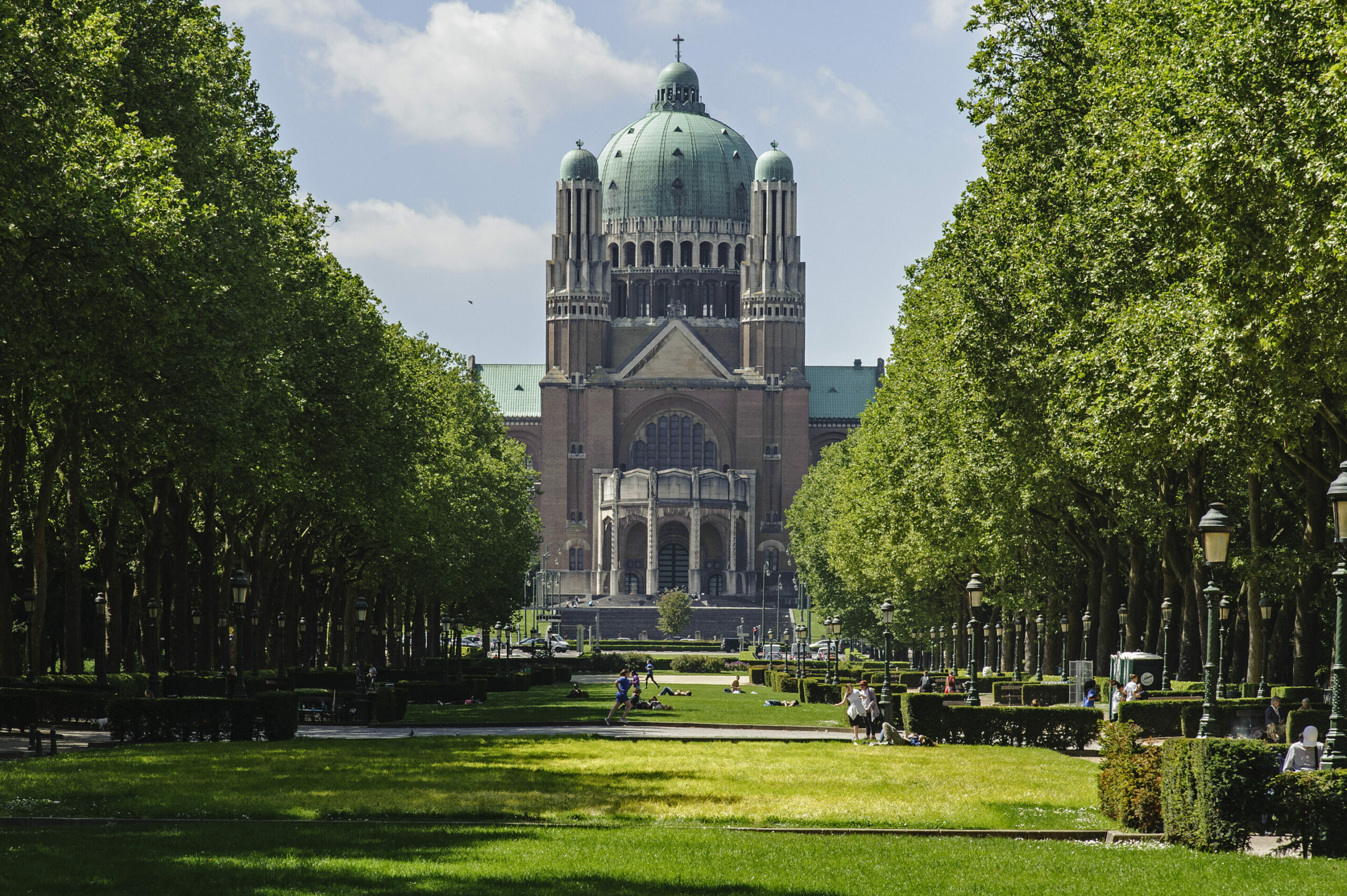
Koekelberg Basicila and Parc Elizabeth. Credit: Wikipedia
Already an independent municipality around 1800, Koekelberg was a working-class neighbourhood with a maze of narrow streets and a burgeoning industry. While beer was brewed, the area mainly made a name for itself with biscuits and chocolate, made by the Manufacture des biscuits et desserts Victoria. (Their famous “Big nuts” bar still exists, although it is now sold by Côte d'Or.)
Today, Koekelberg has plenty to offer on its tiny territory: on the new Comenius site next to the park, you will find schools, childcare facilities, youth organisations, a sports hall, a library and apartments. Additionally, you can easily reach anywhere in the city by metro, tram or bus via the Simonis transport hub.
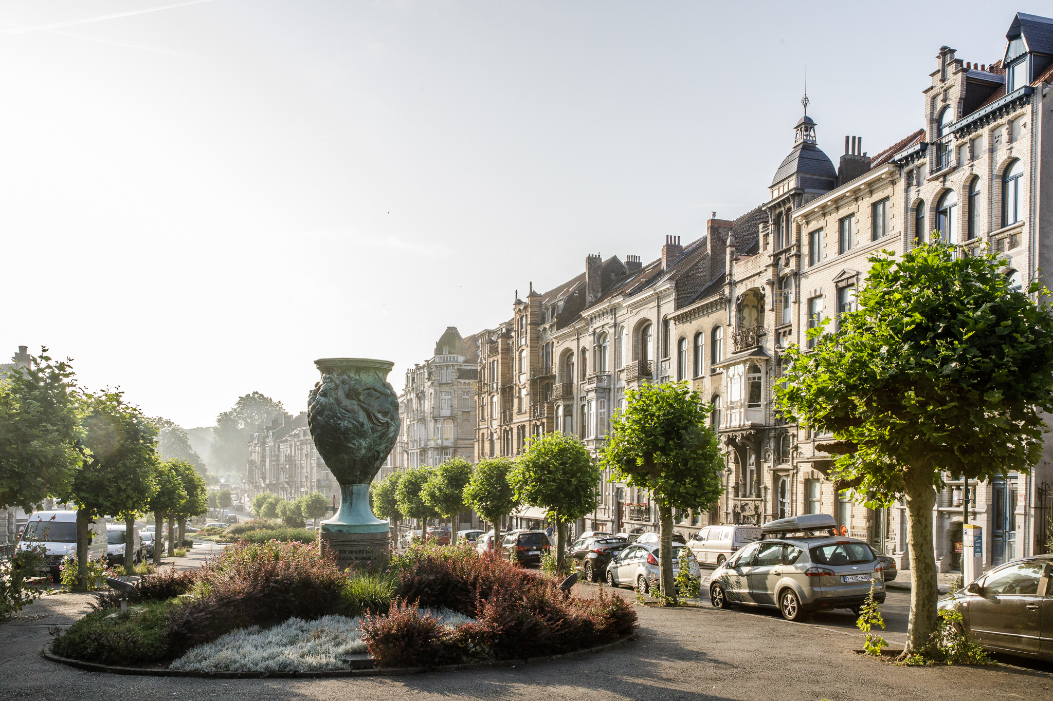
Auderghem
Located between the VUB campus and the Sonian Forest, Auderghem is among the greenest (and most expensive) municipalities in the Brussels Region.
In the south-east of Brussels, the forest defines the green character of Auderghem, with the Red Monastery as its main attraction. With approximately 33,000 inhabitants living in an area of 9 km², it is considerably less crowded than other areas of Brussels.
Auderghem. Credit: Visit Brussels
Auderghem has a messy history. Auderghem, Watermael and Boitsfort used to be three historic villages, which together formed the Watermael domain. In the 18th century, this domain was split into three parts, only to be reunited again by Napoleon in 1811. After Belgian independence, however, Auderghem became a separate municipality again – and remains so to this day.
Today, the municipality is crossed by the long Chaussée de Wavre, with many shops. But behind the large avenues are often quiet and residential suburbs, with terraced houses, flats and villas.
Schaerbeek
With the donkey and the cherry as mascots, Schaerbeek is a large and diverse municipality with more and more trendy bars, restaurants and initiatives popping up.
Schaerbeek, in the north-east of Brussels, is one of the larger and most densely populated municipalities in the Region, stretching from the North Station to the busy Place Meiser and Boulevard Reyers. Well-known places include Place Colignon with its majestic town hall, the sprawling and pleasant Parc Josaphat and the more than 100-year-old Place des Bienfaiteurs.
Schaerbeek. Credit: Visit Brussels
The municipality used to be known for growing Schaerbeek cherries, a variety of sour cherry. The people of Schaerbeek had the privilege of taking their fruit to the Brussels market on donkeys to sell it to the cherry producers. At one point, there were said to be as many donkeys as people living in Schaerbeek.
Today, Schaerbeek is a very varied municipality with densely populated neighbourhoods around Place Liedts, but also residential areas with beautiful architecture and wide avenues such as Avenue Eisenhower, Avenue Voltaire and Avenue Demolder in higher Schaerbeek.
Berchem-Sainte-Agathe
A small, pleasant municipality on the outskirts of Brussels with one of the last agricultural areas in the Region.
With its old village centre somewhat reminiscent of the Provence in France, Berchem-Sainte-Agathe is a peaceful municipality for its roughly 24,000 inhabitants living in the far west of Brussels, behind the Koekelberg Basilica.
Berchem-Sainte-Agathe. Credit: Living in Brussels
Until 1954, Berchem did not belong to the Capital Region of the former province of Brabant, but based on the results of the 1947 language census (published in 1954), it was decided that the municipality would become part of the bilingual Brussels agglomeration.
Today, the municipality is home to many modest terraced houses, maisonettes or flats in slightly taller apartment buildings. The famous Avenue Charles-Quint and the Basilix Shopping Centre function as the municipality's northern border.
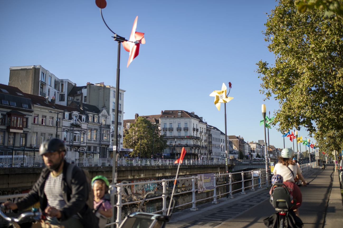
Molenbeek-Saint-Jean
Known to many only as the "hell hole" US President Donald Trump spoke about after the terrorist attacks in 2016, Molenbeek is a densely populated but vibrant area of Brussels – full of potential.
The large municipality lies to the west of the centre of Brussels, stretching from the canal to Dilbeek on the edge of the Region. Molenbeek consists of three large parts: the "old" historic Molenbeek, the "newer" residential and green part beyond the West Station, and the Maritime District to the Tour & Taxis site.
The canal by Molenbeek. Credit: Living in Brussels
From its origins in the Middle Ages until the 18th century, Molenbeek was a rural village on the edge of Brussels. Around the turn of the 19th century, however, it experienced major growth brought on by a boom in commerce and manufacturing during the Industrial Revolution. From the 1950s to 1960s, the municipality experienced strong movements of immigration, turning it into a multicultural district.
Today, there are many shops on the lively Chaussée de Gand, with large markets every Thursday, with many Maghreb bakeries, fishmongers and butchers putting their goods on display. The municipality is easily accessible by various metro lines and borders Brussels City with a row of colourful windmills and a canal.
Saint-Josse-ten-Noode
Colourful and lively, the smallest (but also poorest) municipality in Belgium has an energetic centre and a large influence from the European Quarter.
With over 27,000 people living in an area of just 1.1 km², Saint-Josse is always buzzing. The Chaussée de Louvain is its main artery with shops, restaurants and the famous Jazz Station music venue. In summer, the cosy terraces on the vibrant Place Saint-Josse almost make you feel like you are in the South of France.
Saint-Josse-ten-Noode. Credit: Living in Brussels
Named after Saint Judoc, Saint-Josse was originally a farming village on the outskirts of Brussels, in front of the Porte de Louvain. After the demolition of the ramparts encircling Brussels, Saint-Josse was one of the first areas outside Brussels to urbanise. The rich built houses around the new boulevards and higher parts of the municipality, while industries and workmen's cottages were built in the lower-lying part close to the river Senne.
Today, this divide is still visible: homes range from stately townhouses or apartment buildings from the 1930s to 1930s to modest terraced houses and many flats, while the Jardin de Botanique and the Squares neighbourhood add greenery to this small municipality.