
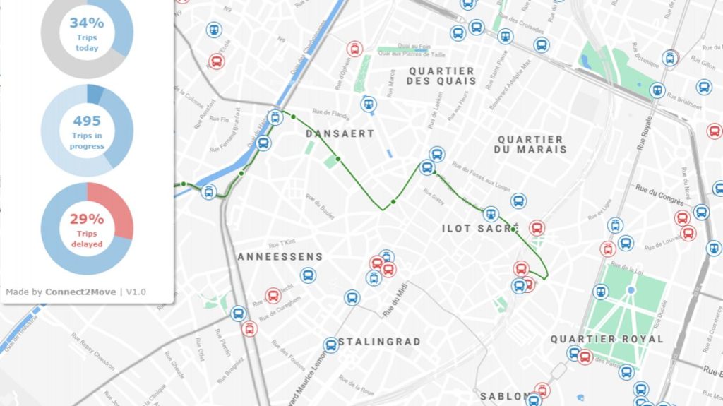
A map on the website Brusselstransit.be shows where various STIB public transport vehicles are in the Brussels-Capital Region, in real-time.
The website was developed by the Liège startup Connect2move and shows red logos for buses, trams or metros that are late, while blue ones indicate that the vehicles are on time.
"Most of the data of public transport companies is easily accessible," said Mathieu Jaspard, business developer at Connect2move, to the RTBF.
The website uses the open data to show a dynamic map with information about the STIB network. It also shows the total number of vehicles completing a trip, and the percentage of those that are running behind. Every trip also shows the time of arrival at the next stop.
The map cannot be 100% as STIB's data does not show the location of its vehicles, but the theoretical service and delays. Connect2Move then interprets that information and shows it in the form of a map. The result is reliable, with a delay of maximum one or two minutes, according to the start-up.
The maps will also show disruptions, like works or diversions, on the network from next month. In the future, Brusselstransit.be will also receive information about vehicles of other public transport companies, such as De Lijn, TEC and SNCB, reports Bruzz.
Maïthé Chini
The Brussels Times