
Europe’s next-generation weather satellite has returned its first images — early data that map global temperatures and atmospheric humidity from 36,000 km above Earth.
The first two images from the Meteosat Third Generation-Sounder (MTG-S) satellite were shared on 27 January at the European Space Conference in Brussels, the Agency said in a release.
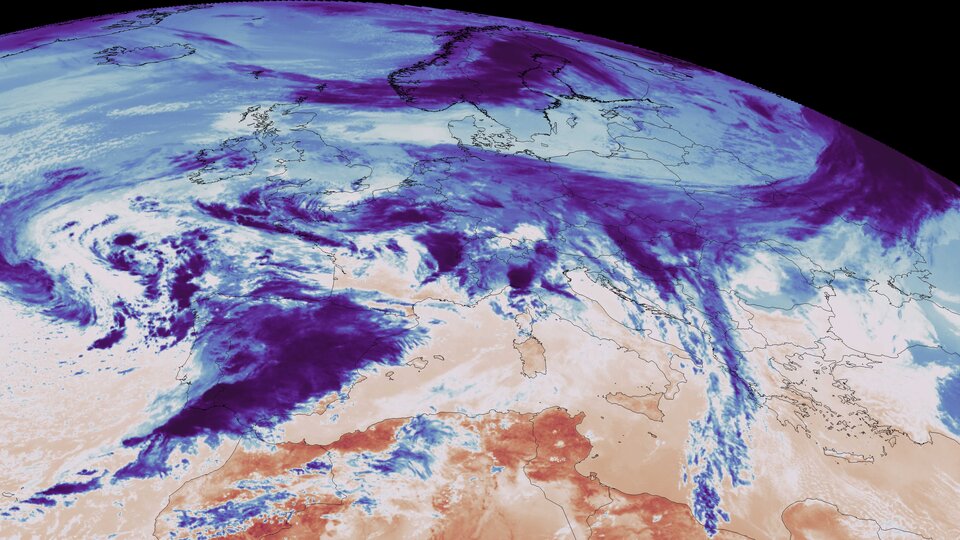
Both images were captured on 15 December 2025 by the satellite’s Infrared Sounder instrument, which observes Earth in infrared light.
One image shows Earth’s surface temperature and the temperature at the tops of clouds, using a long-wave infrared channel. Dark red indicates higher temperatures, mostly over warmer land, while blue marks lower temperatures typically associated with cloud tops.
The warmest areas in that image appear over parts of Africa and South America, with the west African coastline and the Cape Verde peninsula — where Senegal’s capital Dakar is located — among the hottest regions shown.
A second image maps humidity in the atmosphere using a medium-wave infrared channel. Blue indicates higher humidity and red indicates lower humidity.
Land outlines are not visible in the humidity image, but the driest air appears roughly over the Sahara and the Middle East, with another dry region over part of the South Atlantic.
What the satellite will add to forecasts
MTG-S sits in geostationary orbit above the equator, meaning it stays fixed over the same part of Earth as the planet rotates, ESA said.
From that position, it can cover Europe and part of northern Africa on a 15-minute repeat cycle.
The satellite is expected to deliver new temperature and humidity data over Europe every 30 minutes and to complement cloud and lightning observations from the separate MTG-Imager satellite.
The Infrared Sounder on MTG-S is Europe’s first hyperspectral sounding instrument in geostationary orbit — designed to measure temperature and humidity and also observe wind and trace gases in the atmosphere.
Data from the instrument is intended to be used to generate three-dimensional maps of the atmosphere, which ESA said will support weather forecasting and “nowcasting”, a term used for short-range forecasts of rapidly changing conditions.