
The sun is high in an unusually blue Belgian sky. The leaves are sprouting on the trees. You've done your favourite Brussels parks. You've made a special outing to see bluebells in the woods. What next?
I faced this question when spring came last year. I tried a new path out of the city. Surprisingly, the footpath was full of nature and I barely saw a car.
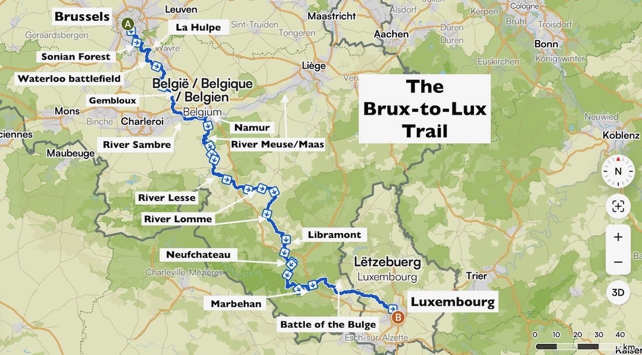
A couple of hikes later, and wanting a new project, I wondered: why not walk to Luxembourg? So I did – all 360 km of it. Here's the story of those 20 days, spread over a year, and how you could hike some or all of it too.
Stunning scenery on the beautiful Brux-Lux trail. Credit: Hugh Pope
The Brux-to-Lux Trail
Rest assured, you need not be a veteran of long-distance pilgrimage trails, peeling boots off your blistered feet in hostels night after night. You won't have to reconcile yourself to the discomforts of camping. You will, however, enjoy the great upsides of a long-distance trail: you will avoid walking near traffic, noise, and anywhere near racing bikes.
On my Brux-to-Lux Trail, I prioritised earthen footpaths. Hills and deep forests. Walking by streams, rivers and lakes. There's a goal to achieve with each walk, rather than returning to the same place. You'll have variety too: villages, fields, woods, farm tracks, and a few country lanes. Romantic houses, abbeys, churches, or chateaux will occasionally enchant you.
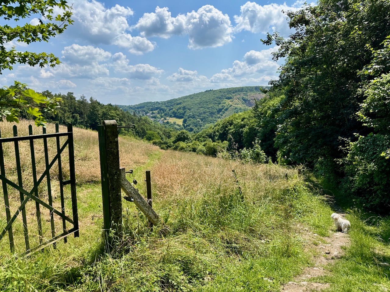
Credit: Hugh Pope
After setting off south from Grand Place in central Brussels, furlongs of wide-open flatness contrast with magnificently tall trees, whether in long straight avenues or in luminous, moss-floored forests. Routes along pretty rivers do not suddenly stop dead for lordly estates, as they do in England.
Paths are almost never overgrown, unlike, say, rural Italy or France. And the route through the Ardennes to Luxembourg ensures there are plenty of rolling hills too.
As I pieced the stages together, I was lucky that I could count on Belgium's excellent network of local trains and buses. It's true that, later on, travel did take me up to three hours each way. But the trains are comfortable, often have power sockets and I always got a seat.
All this meant I could walk a long-distance trail and be back in my own bed every night. I didn't have to go to the expense of a hotel or a restaurant if I didn't want to. I didn't have to carry anything much. I could walk only when the weather suited me. And I had time to recover between the longer hikes.
From fields to rivers
The Brux-to-Lux Trail turned out to have four main sections. The three day-stages of the first section, from Brussels to La Hulpe, were some of the greenest stages of the trail, even within and near the city. The ancient beeches of the Sonian Forest looked spectacular from its well-beaten paths.
The second section after the battlefield of Waterloo was made up of three day-stages dominated by vast farms. Sometimes the path would just be like a pale sandy line drawn through the fields. Woods and copses were frequent, however, and every day on the trail offered plenty of variety.
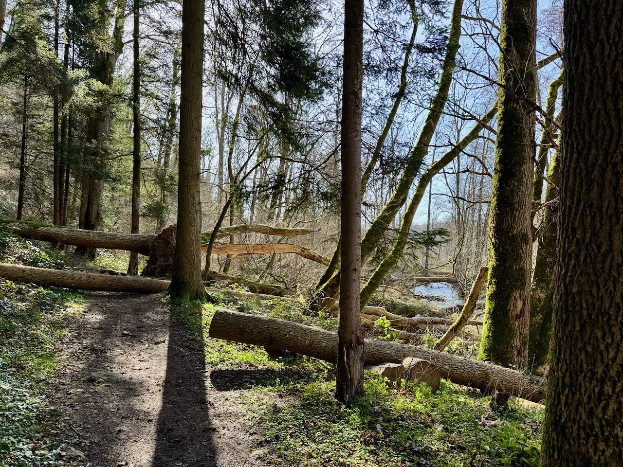
A jumble of storm-felled trees on the path by the River Lomme near Mirwart. Credit: Hugh Pope
The third section of eight day-stages explored what I now think of as Belgium's river country. I followed the Sambre for a day, mainly from the wooded hills above and to the south of the river, since the valley attracts roads, railways and factories. I walked for two days alongside the more splendid Meuse (Maas in Dutch). Again, I regularly took refuge from tarmac and cars in the forested hills to each side.
For three days, I tracked the River Lesse on the way to Rochefort, one of the prettiest sections of the trail. Next I spent a day climbing over to the River Lomme, passing the highest point that I reached on the trail, a heady 370 m above sea-level. For two days more, I walked alongside the Lomme as it wound through Ardennes forests towards Libramont.
The fourth section of the trail covered the last three stages through the Belgian province of Luxembourg. It took longer to get to, so I walked further. The 32 km from Neufchateau to Marbehan was memorable, a misty mid-December day that completely spooked me out. I saw few people, as usual. But the forests were deeper, the trees seemed higher, and the leafless branches along the paths seemed to be in the grip of a pale, silently smothering green moss.
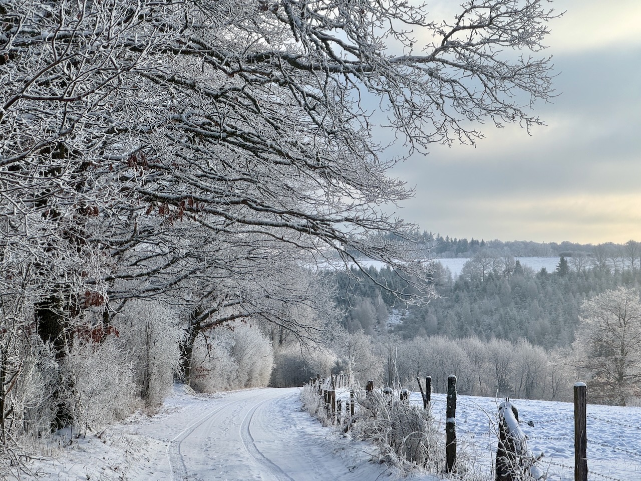
Wintry weather on the Brux-to-Lux Trail. Credit: Hugh Pope
On a ridge early on, I came across a German war memorial to terrible bloodshed here. I had not heard before of the Battle of the Frontiers, the fighting in August 1914 after German troops started the First World War by invading Belgium. French soldiers died in crazily brave bayonet and cavalry charges against lines of German troops, who were often well-entrenched in forests with superior numbers, barbed wire and machine guns.
On just one day, 27,000 Frenchmen were killed all along the front, many right where I was walking; 22 August 1914 remains the bloodiest day in French military history. On that day too, the fog had been dense. Every odd shape in the mist, I felt, was a ghost from that war.
My last day on the trail in Belgium was a 36 km hike. I went in early January, through cold, brilliant sunshine and under blue skies. It is tougher to hike on snow, and smaller paths in the forests were hard to follow. My exhilaration at passing the bollard in the forest marking Belgium's border with Luxembourg was mixed with exhaustion. The next day I could barely move.
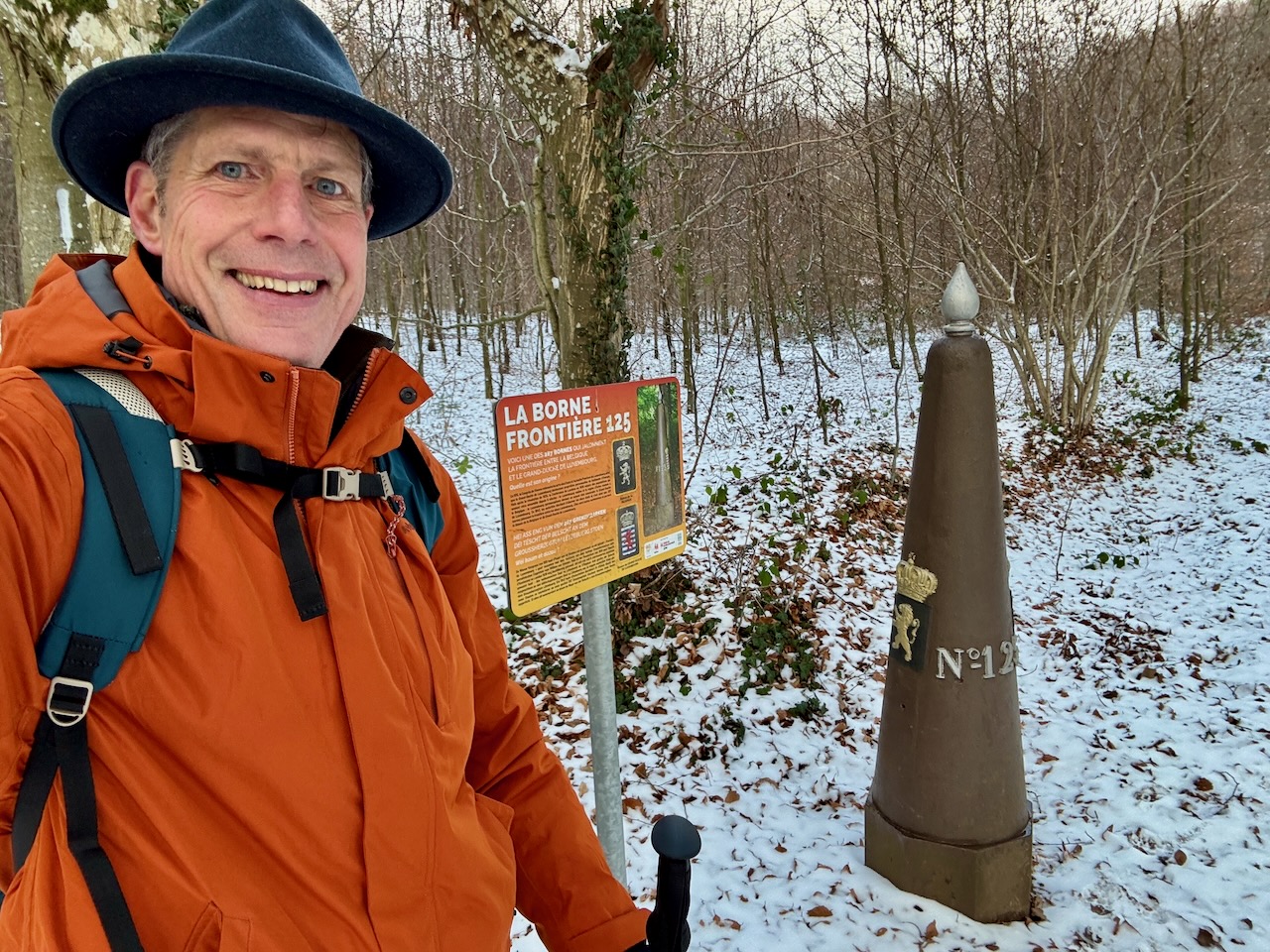
Crossing the Belgium-Luxembourg border north of Arlon. The bollard was put in place in 1843. Credit: Hugh Pope
Getting to know Belgium
Looking back over my Brux-to-Lux Trail, I'm surprised at how different each of the days now seems, and how varied each of the individual days could be. Going from point to point over a distance is a quite different experience from the occasional circular walks I do in nature reserves around Belgium, which are homogenous and can feel enclosed.
I now also feel much more connected to Belgium and its history. Instructively often, this was skirting through other powers' battlefields, not just the Battle of the Frontiers but also Waterloo (1815) and the Battle of the Bulge (1944).
More peacefully, I had no idea how religious the country is. I came across crucifixes, shrines, chapels, churches, religious boarding schools and abbeys all along my route. At the entrance of every village is a shrine, often several. Some are diligently kept up, full of flowers and written prayers.
I passed by several breweries. There was that of the grand Trappist stronghold in Rochefort, abbey beers like Leffe and Aywiers, and straightforward ones like Bertinchamps, which, deep in the vast fields near Gembloux, uses only local barley (most beer brewed in Belgium does not).
Best branding went to the Lesse brewery – "TOP Lesse", under a drawing of a couple of scantily clad bathers – which I happily downed at "La Flobette", a home-made bar that offers petite restauration sauvage on a wooded bank of the river near Gendron-Celles.
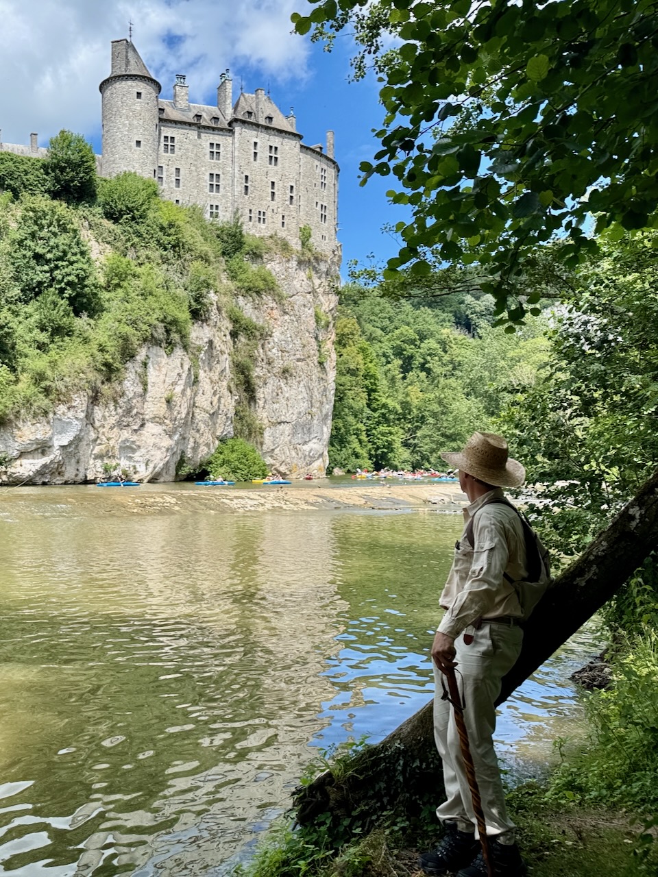
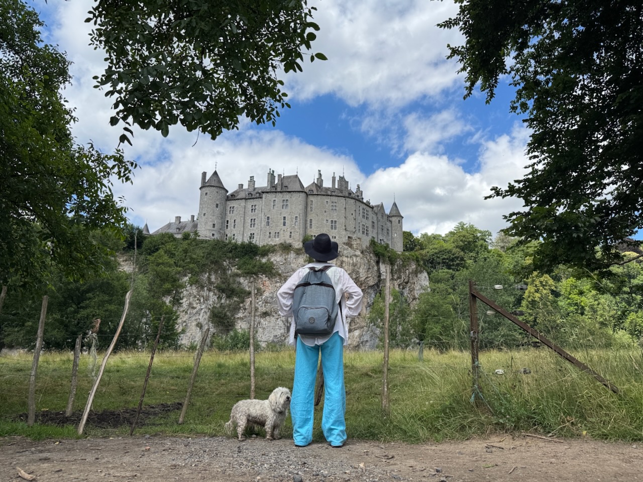
Hugh in front of Walzin Castle. Credit: Hugh Pope
Wildlife was scant along the trail. What little I saw of it was all birds, most memorably joyful skylarks in the great fields. Wooden shooting stands for gun clubs in most forests on the trail were a far more common sight. I wondered what could possibly be left for these "hunters" to kill. Luckily I never saw one of them, and only heard gunshots once or twice in the distance.
Blissful solitude
The lack of people I encountered was also unexpected. Most days I'd be alone on the paths, except when I happened to pass through a recreational park near a town. I saw only four real long-distance walkers with backpacks on the whole journey, even though my trail coincided quite often with Belgium's good network of grand randonnée paths.
If any of this tempts you to set out and try the route, I recommend getting a walking app. I started out with wandelknooppunt.be and moved to komoot.com because it has more features. Both allow you to see exactly where you are and where to go next. You can find all the maps of The Brux-to-Lux Trail for free on Komoot here and detailed accounts of and the GPX files for each day stage here.
So when you next see on your phone that Brussels air quality is yet again listed as "bad" or "horrible", but that sunshine is predicted for Belgium, I hope you'll find the walk to clear your head and heart.