
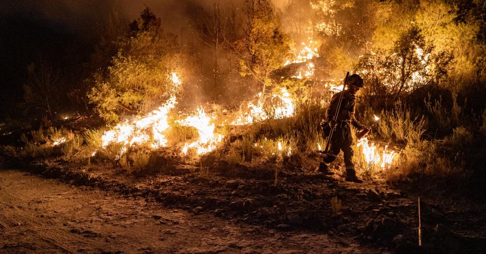
Images of fire engulfing thousands of hectares of forest in France and Spain have raised concerns closer to home: could Belgium one day face the same kind of devastating wildfires?
Belgium is expected to see more periods of intense heat in the coming years, likely resulting in a more wildfires. Wildfire expert, bio-engineer Jan Baetens from UGent, represents Belgium in the European Forest Fire Information System. He told The Brussels Times that heatwaves, recurring droughts and human activities increase the risk of fires spreading across heathlands and open countryside in Belgium.
'Droughts are no longer exceptional events'
Over the last three decades, the situation in Belgium has changed. "It used to be focused on April, but now it actually starts in March. And over the last 30 years, we have also seen a second peak in July and August," said Baetens.
According to Wallonia's Department of Nature and Forests (DNF), spring is the first critical period. Dry vegetation left over from winter might ignite easily before new growth appears. Summer droughts then create another period of elevated risk.
Over the past weekend alone, five vegetation fires broke out across Wallonia, requiring several rescue zones to intervene, sometimes simultaneously. One of the largest fires burned around seven hectares near Gedinne. Another two hectares were devoured by a blaze in a nature reserve near Ghent.
"We really have to see these as a recurring risk," the a DNF representative told The Brussels Times. "Droughts are no longer exceptional events."
Despite the increasing risk, Baetens says Belgium is still a long way from the catastrophic fires like those that have ravaged other parts of Europe.
"France has experienced much more severe heat than we have; it also has lower humidity and longer periods without rain than Belgium, creating conditions that allow fires to spread across thousands of hectares," said the DNF spokesperson.
Belgium also has the advantage of being densely populated. "If a wildfire starts, somebody usually sees the smoke, calls 112, and firefighters are often on the scene within half an hour," Baetens explained. That rapid response leaves far less time for a fire to grow out of control.
Why does Flanders burn more often?
Natuur en Bos (ANB), the Flemish Agency for Nature and Forests, told The Brussels Times Flanders is currently under an orange warning alert. Heathlands and coniferous forests in the Campine region of Antwerp and Limburg are among the most vulnerable areas.
These landscapes contain dry grasses, shrubs and pine trees that ignite much more easily than broadleaf forests. Historical data also shows that around 80% of Belgium's recorded wildfires have occurred in Flanders.
According to Baetens, open landscapes receive direct sunlight and are exposed to wind, drying vegetation much faster than forest floors protected by tree cover.
"In Wallonia, you generally have forest cover," he explained. "The vegetation underneath the trees and the soil remains more humid."
The DNF says the greatest danger in Wallonia currently lies in open environments such as fields, meadows and grasslands rather than forests themselves, although prolonged drought also increases pressure on woodland.
Climate change?
ANB says longer dry spells and frequent heatwaves are drying vegetation more quickly, thus allowing fire to spread faster. Baetens argues that climate change is only one part of the equation.
"Climate change creates the conditions for fires to spread," he said. "But you still need an ignition."
In other words, hotter weather makes fires easier to sustain, but it does not start them. That ignition almost always comes from people. According to ANB, more than 90% of wildfires in Flanders are linked to human activity. The DNF estimates the figure is similarly high in Wallonia.
A 2020 study by Ghent University researchers produced Belgium's first national wildfire ignition map to identify where fires are most likely to start.
It found that the highest ignition probability was concentrated in the provinces of Antwerp and Limburg, particularly in heathlands and military training areas.
The study concluded that most wildfires in Belgium are caused by human activity rather than natural events, leading researchers to recommend stronger public awareness campaigns.
Discarded cigarette butts, campfires, barbecues, machinery that creates sparks and deliberate acts all contribute to the problem. Both forestry agencies regularly deal with roadside fires caused by cigarette ends thrown from moving vehicles.
Preparedness
Both forestry agencies say that the country has invested in wildfire preparedness over the past decade. Firefighters have received additional training, intervention plans have been updated, and helicopters can be deployed to support firefighting operations during larger incidents. Cooperation with neighbouring countries, like France or Germany, in the event of megafires in transboundary zones is always an option, explained the DNF.
ANB is carrying out daily wildfire risk assessments, especially during heatwaves. They are also improving water supplies for firefighters and removing highly flammable vegetation. Vulnerable conifer plantations are also being replaced with more resilient mixed forests. The agency has also increased ranger patrols during high-risk periods and is testing AI-assisted camera systems that can detect smoke quickly.
Wallonia does not publish a public wildfire map because of its more varied landscapes, but it works closely with the Royal Meteorological Institute (IRM) to assess daily conditions and issue recommendations to mayors, governors and emergency services.
