
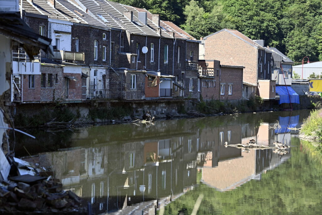
One year ago this week, the skies above Belgium opened, seeing unprecedented rainfall wreak havoc on large parts of the country, especially in Wallonia and Limburg.
The deadly floods — 41 people lost their lives as a result of the extreme weather — saw buildings being flattened and even entire villages being destroyed, damage that will require billions of euros to repair. Many families lost almost all their possessions, and some are still displaced after their house was demolished.
Climate change has never been so obvious as it is now, affecting regions that usually don't experience extreme weather conditions regularly. Experts have warned that long periods of droughts are here to stay, and these make the country more susceptible to flooding during moments of heavy precipitation, as the ground is too dry, meaning heavy precipitation hardly penetrates into the soil.
What measures has Belgium been taking to ensure that, in a future in which droughts and flooding become more regular, the outcome won't be as damaging?
Lessons learned in Wallonia
The region that was most heavily hit by the floods is working on various levels to prevent a similar incident from causing the same damage in the future.
In April, the government started analysing the 161 recommendations made by the investigation commission in the Walloon Parliament aimed at responding to challenges related to the causes and management of flood risks in the context of climate adaptation.
After the floods, the so-called Celex (Flood Expertise Cell) was set up, bringing together meteorological experts from the Royal Meteorological Institute (KMI), hydrological experts, river managers and relevant emergency services, which should see governors, local authorities and emergency services being briefed on the situation more quickly, ahead of the disaster already happening.
To better inform local authorities and the public, a new website was launched by the region's hydrological service, where all data on precipitation, water levels and flows are gathered on a single platform. It will also publish pre-warnings and flood warning messages.
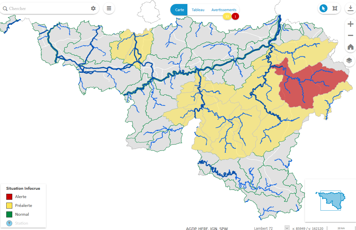
A map on the hydrometrie website from Wallonia's government showing what areas in the region are most at risk. Credit: Hydrometrie Wallonie
Although there is still no concrete tool in place to predict how intense rainfall will affect specific watercourses, from rivers and canals to sewers, the KMI does send out information about the impact of precipitation on the Walloon dams.
Aside from improving the response system, the region is also looking to prevent a similar incident, among others by improving its water storage capacity.
At the Eupen reservoir, which played a crucial role in the damage caused by the floods, the capacity has already been expanded from 2.8 million cubic metres to 7 million, according to VRT News, however, this is still not enough to absorb the amount of precipitation that fell in July last year.
Related News
- Wallonia: Over €20 million required to repair flood damage
- King Baudouin Foundation raises €1.5 million for flood relief
- 90% of insured flood victims compensated for July 2021 floods
The region is also focussing on "temporary immersion zones" (ZIT), a natural or constructed area where water runoff is channelled towards temporary storage to prevent flooding of a settlement area.
Finally, the region is stepping away from building in flood-prone areas (near a river, for example), and is looking at what sites should be rebuilt in a more flood-proof way.
Flanders' battleplan
Although the region was not as heavily impacted as Wallonia during the floods last July, the extreme weather still highlighted the lack of preparedness for such conditions in the region. If the situation in Flanders had been as bad, it would have cost more than €8 billion in damages.
Last week, a ten-point plan was introduced to protect Flanders from such a "water bomb" based on recommendations from a multidisciplinary panel of experts.
"The desired level of water safety in Flanders can only be achieved if the natural functioning of the water system is rebuilt in every upstream landscape and in every valley. If water does not get the space it needs, it will make that space itself, as last summer showed," Henk Ovink, chair of the expert group, noted in the report.
He said this space should be freed up all across the region, including in tidal rivers, and watercourses, with the help of "sponge landscapes" which retain water better, and in towns and villages. This should also help supplement the water reserves to bridge periods of drought.
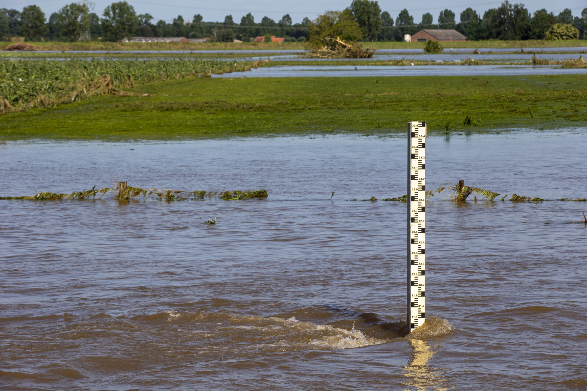
The water level in Heppeneert in Maaseik, where heavy rainfall caused a risk of floods, on 17 July 2021. Credit: Belga
The report stressed the need for "clear water objectives" at the Flemish level by 2023-2024, which should include integrated and adaptive action programmes per sub-basin, making storage potential areas the driving force for spatial-economic development, and transforming the existing legal framework and instruments for climate-proofing landscapes, among others.
Additionally, a "Water Commissioner" should be appointed in the region, who will be in charge of the Flemish water security, while more structural funding has to be provided for the long term. The region must also work on educating future generations on better water management.
Responding to the report, Flemish Mobility and Public Works Minister Lydia Peeters said she would work with the recommendations to roll out concrete actions. "After all, the future is now and we must spare future generations as much as possible from the harmful effects of such a water bomb."