
In a bid to help people travelling by public transport in Flanders to better plan their journey, public transport operator De Lijn's real-time travel information will be integrated into Google Maps from Wednesday.
As is already the case with information about the scheduling of trains run by railway operator SNCB and Brussels public transport operator STIB, Google Maps now shows in real-time whether a De Lijn bus or tram is on time or delayed or running on time.
"Until recently, when a traveller used Google Maps to plan his route, he only saw the theoretical timetable. The real-time arrival of rides that were delayed, cancelled or brought forward was not visible in Google Maps," a statement from the company read.
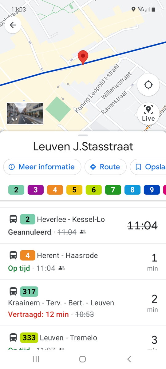
An example of De Lijn realtime info on Google Maps. Credit: De Lijn
However, from Monday, this updated information will be available in real-time. "De Lijn is going a step further to optimise the travel information for its passengers. This addition makes it even easier to travel by public transport in Flanders," the statement added.
Related News
- Brussels metro struggles to keep up with proliferation of graffiti
- Brussels to put women at heart of mobility
- De Lijn invests up to €3.2 million in leather seats
De Lijn's latest customer satisfaction survey highlighted that travellers already appreciated the improved travel information, an element the company stated it is working on to further improve and make more reliable.