
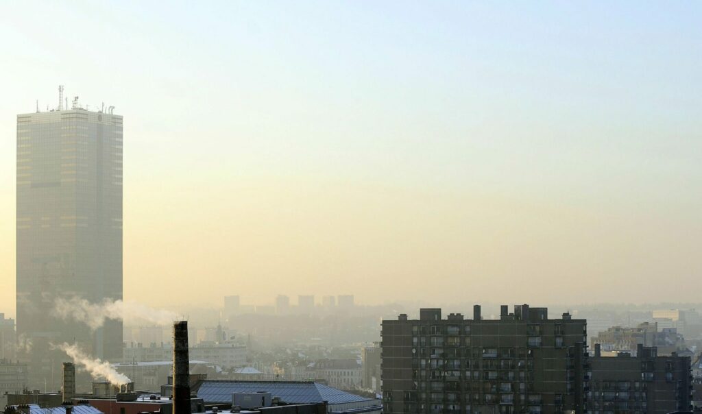
In recent days, Belgium has been basking in sunny weather and has experienced tropical temperatures — the mercury is set to rise to 30°C later this week — and is increasingly accompanied by heavy clouds and the possibility of storms, as in tropical countries.
Rozemien De Troch, a climate scientist at the Royal Meteorological Institute (KMI) explained to The Brussels Times how unusual this weather is, what has caused it, and whether we are set to expect warmer and drier weather in the coming years.
How abnormal are the temperatures and drought experienced in recent days/weeks for this time of year?
The average temperature in Uccle (where the weather station is based) for May is currently 14.8°C, which is around the normal value (13.9°C for the period 1991-2020). However, the average maximum temperature in Uccle for May is currently 2°C above the normal value (20.4°C compared to 18.4°C for the period 1991-2020).
For Uccle (and also for the rest of Belgium), the very low levels of precipitation are remarkable. At Uccle, the total precipitation for the spring months (March, April, and May) is currently 40.3 mm (precipitation for May 15). During the spring of 1976, 69 mm was recorded in Uccle.
Currently, the 2022 spring is even drier than the 1976 spring in terms of precipitation quantity only and is the second driest spring in Uccle since records began (the 1893 spring was the driest with 37.6 mm of precipitation in Uccle).
Some precipitation is still expected next week. In any case, we will end spring with a precipitation amount in Uccle very close to that of 1976.
When it comes to the drought, the Standardised Precipitation Index compared this spring to the past 30 years (1991-2020) and recorded a 'dry' to an 'extremely dry' season for Belgium.
What is the reason behind this? Is it as simple as blaming it on global warming, or is there more to it?
Drought is a complex phenomenon that is determined by several parameters.
In addition to precipitation quantity, for example, evaporation, surface run-off, water management and other elements play an important role. But in general, we can say that in Europe and in Belgium, climate warming increases the risk of drought and makes it worse.
Over the last few decades, experts have observed a decreasing trend in spring precipitation. For Uccle in particular, this represents a decrease of around 4% since 1961.
Related News
- Weather: Temperatures in Belgium climb to 30℃ this week
- Top ten Brussels parks to unwind in
- Oil and gas giants’ plans threaten to accelerate climate change
Moreover, the droughts experienced during spring in recent years (except last spring 2021), are in line with what climate models expect for our region in the future: as temperatures increase, warmer air can hold more water vapour before becoming saturated, and it will take longer for the rain to fall. Once it rains, however, the intensity may be stronger.
Today and this week is supposed to rain and storm, what causes this?
We are indeed expecting thunderstorms this week. A high-pressure area is situated over almost all of Europe this week, with the core of the high-pressure area over Eastern Europe and a complex low-pressure area over most of the northern Atlantic.
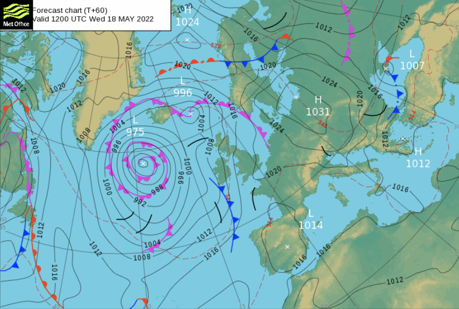
Map showing the high and low-pressure areas expected later this week. Credit: Met Office
This will bring very warm air from the south to our region of the world. For Wednesday and Thursday, we expect temperatures around 30°C for Belgium. As a result, the energy builds up and the air becomes unstable. When (remnants of) disturbances connected to the low-pressure zone approach, they will provide the necessary moisture for the development of thunderstorms.
Especially on Thursday and Friday, we expect such thunderstorms in Belgium. At the moment, it is impossible to say exactly how intense these will be and in which regions.
On Friday, the high-pressure area will crumble and the low-pressure zone will expand towards Scandinavia. We will then enter cooler maritime air, which will be transported between the high-pressure area of the Azores, which will extend to Central Europe, and the low-pressure zone, which will stretch from just about Iceland to Finland.